Scientists find warm water beneath Antarctica’s most at-risk glacier
Thwaites Glacier is melting fast. But to understand how climate change is driving its decline, scientists need to send instruments through 2,000 feet of ice into the water below.

Researchers on Antarctica's Thwaites Glacier peer into a crevasse. Image Credit: Seth Campbell
Aurora Basinski crouches in a tent on a glacier jutting out from Antarctica, half a mile off solid land. She’s tinkering with a device called a VMP, which measures water temperature and salinity, when she starts cursing.
Thirty-six hours before, a storm moved off West Antarctica’s Thwaites Glacier, giving Basinski and her fellow investigators a tiny, critical window of time. They dug their equipment out of snow drifts as tall as themselves and on January 8 began hot-water drilling a 14-inch-wide hole down into the glacier.


Basinski is one of about 50 researchers working on the eastern tongue of Thwaites Glacier as part of the International Thwaites Glacier Collaboration (ITGC). The $50 million, five-year study is supported by the U.S. Antarctic Program and the British Antarctic Survey. The goal is to better understand how climate change is affecting Thwaites, nicknamed the “doomsday glacier” because it’s melting so quickly. Researchers will deploy all manner of scientific instruments across its surface. But to really understand what’s happening with Thwaites, they also need to send instruments into the water below it.
And that means drilling a hole through 2,000 feet of ice.
The team on the aptly named MELT project drills in shifts for 36 hours and by the time they hit water below the glacier, their borehole is twice as tall as the Eiffel Tower. Basinski and her advisor, New York University mathematician and ITGC Principal Investigator David Holland, immediately begin a “science shift,” trading in drilling tools for fine-tuned scientific instruments. It’s already the middle of the night, and when Basinski’s VMP acts up, she's forced to stay awake fiddling with the device for another 12 hours.
“You want to get good data,” she says. “You have one shot.”

Winds blow through the ITGC research camp where David Holland and Aurora Basinski conduct their work. Image Credit: David Holland and Aurora Basinski
Runaway Glacier
Thwaites Glacier is a fragile piece of one of the most rapidly changing places on Earth. That pace of change is what caught people’s attention about two decades ago, Holland says. Thwaites’ elevation falls by several feet every year. Scientists theorize that as the leading edge of a glacier retreats farther inland, the thicker ice above begins flowing down toward the sea faster. This creates a runaway effect of retreat, thinning, further retreat, and, ultimately, collapse.
“If a glacier collapse occurs in the next decade to century, or centuries, it will be here,” Holland says. “And it will be triggered by warm water and be unstoppable.” Thwaites could also trigger ice loss in connecting areas of West Antarctica, scientists believe. “Everything that we’ve seen, particularly from satellite and remote sensing in the last decade or so points to this area becoming more active,” says Paul Cutler, program director of glaciology, ice core science and geomorphology at the National Science Foundation. “And it’s not acting in isolation. If it starts rapidly retreating, it starts acting on the neighboring glaciers as well.”
The ice shelf that Basinski, Holland, and the rest of their team shared from mid-December to mid-January is like an ice cube in a glass of water. Because it’s over the ocean, it won’t directly contribute to sea level rise. But about half a mile away is what scientists call the grounding zone, where this “flowing” piece of Thwaites sitting on the water meets the “grounded” part attached to the seafloor.
It’s this ice atop solid ground—a massive ice cube on a countertop—that climatologists worry about. “The ice cube I’m standing on is holding [back] the ice cube on the kitchen counter,” Holland says from Thwaites’ eastern ice shelf.

Changing winds and currents carry warm water beneath Thwaites Glacier, accelerating ice melt on its underside. As the glacier loses its grip on the seafloor, the grounding line shifts back, hastening retreat. Image Credit: International Thwaites Glacier Collaboration
Already, the melting of Thwaites Glacier, which is roughly the size of Florida, accounts for 4% of global sea level rise on an ongoing basis. And the amount of ice flowing from it and its glacial neighbors has almost doubled in the last 30 years. Current mathematical models illustrate that if it were to collapse, which scientists believe will happen in the coming decades or centuries, much of western Antarctica’s remaining ice will become unstable.
If Antarctica were to lose only Thwaites, the Earth’s oceans would rise by about two to three feet or more, researchers believe. That’s enough to cause major flooding in New York City and completely engulf some low-lying cities like New Orleans and Venice, Italy, with seawater.
And if the loss of Thwaites triggered the collapse of the rest of the West Antarctic Ice Sheet, the global sea level could rise by more than 10 feet. “It can feel very far away,” Andra Garner, a climate scientist at Rowan University who is not part of the ITGC, says of melting glaciers. But “coastal sea rise is a problem for communities in itself,” she says. If the seas were to rise by 10 feet, Holland says, the effects on countries like Bangladesh, coastal states like Florida, and major cities like New York, London, and Shanghai will be “profound.”
Higher seas can also mean intensified storms. “On the East Coast we’re concerned because we already see sea level rise [playing out] in the background,” says Cutler, who’s based in Virginia. “Storms are able to encroach inland.” Even a minor hurricane, which wouldn’t cause intense flooding today, Garner says, could have a much worse effect in deeper coastal waters.
And to make matters worse, storms themselves seem to be growing. Garner’s research shows that from 850 to 1850, storms similar in size to Hurricane Sandy were likely to occur about once every 500 years in New York. Today, Hurricane Sandy is what she calls a “25-year storm,” meaning one that has a 1 in 25 chance of hitting in any given year. But if our current patterns of carbon dioxide emissions continue—and glacial melt along with them—Hurricane Sandy will be a 5-year storm in New York by 2100.
Ground Truth
Climate models rely on mathematics to describe how energy and matter interact in the atmosphere, on land, and in the ocean. About 30 organizations around the world, Holland says, continuously develop them to better understand the complexities of the Earth’s past, current, and future climate. But these models are limited, unable to account for the day-by-day shifting of glaciers’ grounding lines, for example, or features yet to be discovered. This leaves sea-level-rise projections with “a big asterisk called ‘Thwaites,’” Holland says. “And Thwaites is gonna run the whole show.”
That’s where the ITGC comes in.
The location, shape, and behavior of Thwaites’ grounding line, a feature that is bound to play heavily into future climate models, was unknown a decade ago. But from 2011 to 2014, Pietro Milillo of NASA’s Jet Propulsion Laboratory and his team used satellite data to map out the grounding-line retreat of Thwaites and the neighboring Pine Island, Smith, and Kohler Glaciers.
Shortly after, a team of Seoul National University scientists used remote sensing data to show that the Thwaites Ice Shelf—the part of the glacier hanging over the ocean—is disintegrating quickly and its rate of shedding ice into the sea is accelerating. That made Thwaites a “top spot” for concern, Cutler says.
Then, in January 2019, Milillo’s team made a startling discovery.
Their remote sensing work revealed a Manhattan-sized cavity against the grounding zone on Thwaites’ western side, a place too crevassed for scientists to conduct on-the-ground research. The existence of such a cavity suggests that warm water below Thwaites licks at an already-unstable section of its ice shelf—a phenomenon that could hasten Thwaites’ retreat, but isn’t accounted for in models, Milillo says.
His team’s findings also revealed that Thwaites’ grounding line moves by a few miles with the tides—another feature that’s not taken into account by existing climate models.
Even the boundaries of Thwaites are hard to define, says Slawek Tulaczyk, a glaciologist at the University of California, Santa Cruz and a principal investigator of the ITGC. Whereas the boundary between glacier and rock are well-defined in places like Yosemite, he says, “in Antarctica, you more or less have a sheet of ice. Thwaites is a fast-flowing piece of ice on the sides, rubbing against slow-moving ice in the middle. There is no rock wall.”
About three decades of research show that these boundaries can shift over time as the glacier widens and narrows, or the grounding line shifts. “Models aren’t great at predicting that right now,” Tulaczyk says. “It’s much easier to write code where things are set and don’t change.”
Though they lack a layer of complexity, today’s climate models do offer a glimpse into what Earth’s future might look like. For comparison, imagine planning a road trip with only a globe. You’d be able to draw a line from your starting point to where you want to end up. Once you hit the road, with a globe in hand, you could hypothetically head in the proper direction. But to successfully end up in the state, town, and street of your destination (and get traffic reports along the way), you’ll likely want something more detailed.
Similarly, climate models need another layer of complexity to better assess Thwaites’ future and its potential effects on the planet: They’ll need to evolve from globes into Google Maps.
A Glimpse Beneath the Ice
Back on the ice in Antarctica, after 12 hours of toying with the VMP, or vertical microstructure profiler, in a research tent, Basinski and Holland finally figure out what’s wrong with the highly sensitive probe: The noise from the generators surrounding them had created electrical interference strong enough to throw off the VMP’s readings.
Once fixed, Basinski lowers the VMP—a little probe on a long wire—down the 2,000-foot borehole and into the water below. The instrument soon gets a read on turbulence, the mixing of the colder surface water and warmer, saltier, water below, a phenomenon that can stoke further melting of the glacier potentially faster than warm air can.

The 2,000-foot borehole, referred to as a “Thwaites Glacier access point,” stays covered when scientists aren’t deploying their instruments. Image Credit: David Holland and Aurora Basinski
“It’s really exciting to have it in the ocean and to see the data that is coming back,” Basinski says. “It all looked good and reliable.”
Sharing this corner of Thwaites is Britney Schmidt, an ITGC principal investigator and Georgia Tech astrobiologist, and her team, which is responsible for a 12-foot torpedo-like robot called Icefin. On January 10, Schmidt and her team lean over the borehole and pull on Icefin’s tether, guiding the yellow robot out of the water and ice after six hours of exploration, its third of four trips. Icefin carries data about the temperature and salinity of the water in Thwaites’ cavity as well as the first-ever images from the grounding zone. Unlike the researchers’ other instruments, Icefin can be guided away from the borehole using a remote control, allowing the researchers to capture readings over a wider area.
“Deploying a complex system is never straightforward, but the robot was a champ and we actually beat our personal bests in several ways,” Schmidt said in an email. Icefin completed its two longest trips ever, venturing over a mile out from the borehole. “We actually got to the end of our tether on our second dive out there,” Schmidt wrote.
Within a matter of days, the ITGC researchers receive their first readings.
The water beneath the borehole is about 160 feet deep. The top half of it is cold water, a few degrees above freezing, and the lower half is warmer, saltier water, Basinski finds. Based on this even splitting, it would seem that turbulence—the rapid mixing of warm and cold water—is low. That means the warm water isn’t readily able to heat up the cold water above it, which could be good news for Thwaites.
But the researchers aren’t celebrating yet.
We can’t ignore the fact that this warm water is there and touching the ice, Basinski says. This warm water, she adds, is from our active heating of the atmosphere. When the atmosphere warms, wind patterns change, which ultimately affects the shape of ocean currents. Scientists already know that changing currents, which now shepherd warm water to Greenland, are to blame for much of glacial melting in Earth’s Northern Hemisphere. The same might be happening in the South at Thwaites, they fear.
And, Holland adds, not all of Thwaites behaves the same: Under its heavily-crevassed, quick-moving western tongue, it’s very possible that warm and cold water are mixing.
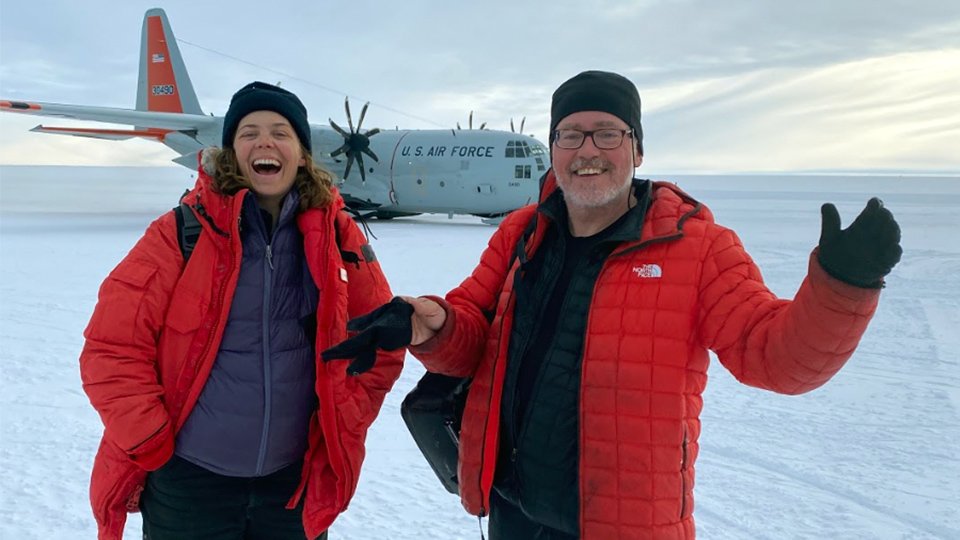
Aurora Basinski and David Holland depart from West Antarctica. Image Credit: David Holland and Aurora Basinski
Now that the ITGC researchers have returned home, they’ll pore over more data, much of which is being beamed to them by tools they’ve left on the ice. Some team members plan to return to Thwaites next year or the following, or will visit for the first time. Some, like Basinski, don’t wish to return at all. “Antarctica is a lot of fun. But [returning there] would mean a lot of digging,” she says, referring to unearthing tools from a year’s worth of snow —about 10 feet.
With the information they collect over the five years of the ITGC, they hope to map out the glacier in detail.
“By doing that, we help understand what the linch pins are in the system,” Schmidt wrote in an email. “We know from a whole host of data that the climate is warming, that the ocean is warming and that Thwaites is changing rapidly, but the rates of change under the ice are uncertain without these new data.”
These data “will help beat down the uncertainty in how the system is changing,” she wrote. And that will allow scientists to make better climate predictions and society to properly respond.
Thwaites has the power to rapidly split and shed, to raise the seas, to inundate coastal cities. “The future of our planet’s sea level is tied up almost certainly with what I’m standing on and what the folks behind me are working on,” Holland said from the glacier in January, gesturing to Schmidt’s team and Icefin behind him. “The impact, around the world, will be on tens or hundreds of millions of people. And the impact in dollars is huge.”
For now, that impact comes with uncertainty. And that uncertainty is hinged on the amount of carbon dioxide we emit into the air now and moving forward, says climate scientist Andra Garner. It can feel dire, she says, but the future of Thwaites and our planet is largely in humans’ hands. “That’s our source of hope,” she says, “that we have the chance to change things.”
NOVA science correspondent Miles O'Brien assisted in reporting this article.
Correction: A previous version of this article incorrectly stated that underneath Thwaites Glacier, a layer of warm water is sitting above colder water. Cold water is in fact above the warm water.
 Sukee BennettPosts By This Contributor