
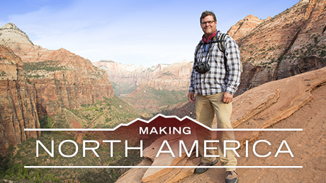
Making North America
Host Kirk Johnson explores how the continent was shaped—and how it shaped us. Airing June 21, 28, and July 5 at 10 pm on PBS Airing June 21, 28, and July 5 at 10 pm on PBS
Program Description
Education and Outreach Resources
Interested in bringing your local community together through a Making North America screening or “ancient rock show?” Email novaeducation@wgbh.org for more information.
Preview | 53:02
Full Program
Full program available for streaming through
Watch Online
Full program available
Soon
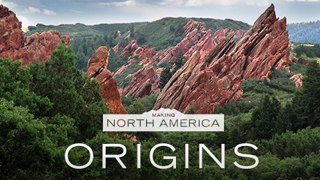
Making North America: Origins
Experience the colossal geologic forces that shaped our continent over billions of years. Airing August 1, 2018 at 10 pm on PBS Airing August 1, 2018 at 10 pm on PBS
Program Description
Transcript
Making North America: Origins
PBS Airdate: November 4, 2015
KIRK JOHNSON (Sant Director, Smithsonian National Museum of Natural History): North America, the land that we love: it looks pretty familiar, don't you think? Well, think again! The ground that we walk on is full of surprises, if you know where to look.
As a geologist, the Grand Canyon is perhaps the best place in the world. Every single one of these layers tells its own story about what North America was like when that layer was deposited.
So, are you ready for a little time-travelling?
I'm Kirk Johnson, the director of the Smithsonian National Museum of Natural History, and I'm taking off on the fieldtrip of a lifetime,…
Look at that rock there. That is crazy!
…to find out, "How did our amazing continent get to be the way it is?"
EMILY WOLIN (Geophysicist): Underneath Lake Superior, that's about 30 miles of volcanic rock.
KIRK JOHNSON: Thirty miles of volcanic rock?
How did the landscape shape the creatures that lived and died here?
Fourteen-foot-long fish, in Kansas. That's what I'm telling you!
And how did we turn the rocks of our homeland…
Ho-ho. Oh, man!
…into riches?
This thing is phenomenal.
In this episode, we hunt down the clues to our continent's epic past.
You can see new land being formed, right in front of your eyes.
Why does this golf course hold the secret to the rise and fall of the Rockies? What forces nearly cracked North America in half? And is it possible that the New York City skyline…
I've always wanted to do this.
…was once dominated, not by skyscrapers, but by towering mountains?
We're uncovering secrets hiding in our own backyard.
Peel it back!
Woo hoo! That is unbelievable!
Making North America: Origins, right now, on NOVA.
North America: our continent, filled with all these spectacular landscapes. They look like they've been here forever, but they are anything but permanent. The truth is, our continent has had its ups and downs, literally. It's an epic tale of creation and destruction, playing out over thousands, millions, even billions of years.
Wow!
We're going to trace this story back to the very beginning, to the origins of North America.
Our journey starts here, in the American Southwest. This place is a paradise for geologists and one of our national treasures. It is, of course, the Grand Canyon.
That is a big hole!
And it gets me every time.
Wow! This is absolutely awesome!
The landscape is breathtaking and so much more.
As a geologist, the Grand Canyon is perhaps the best place in the world. It's this incredible 300-mile-long slice through the earth, and you can see layer after layer after layer of sedimentary rock.
Each layer is a time capsule, with a slice of our continent's epic history locked inside, stretching hundreds of millions of years into the past.
Every single one of these layers tells its own story about what North America was like when that layer was deposited. So, here, in one place, you have this incredible story of our continent, laid out for your viewing pleasure.
But, to really tell that story, I've got to step out of my comfort zone.
So, are you ready for a little time-travelling?
I'm going to rappel down the cliff to get up close and personal with these rocks.
So, it looks like I'm good to step off the edge of the Grand Canyon. I can't believe I'm doing this.
I really don't like the fact that you've put a cactus right here.
This is the moment of truth! Oh, baby! This is not the easiest thing to do, especially in a-hundred-degree heat, but it's worth it.
Every foot I descend transports me further back in time.
The first layer you come to, in this part of the canyon, is this pinkish rock I'm hanging next to right now. It's called the "Esplanade" layer, and like all the rocks in the Grand Canyon, it's an ancient landscape frozen in time.
Three-hundred-million years ago, this place, and all of the American Southwest, was a vast sea of sand. Hot, dry winds sculpted an immense desert landscape of endless dunes. Over time, the sand compressed and transformed into the sandstone that forms the top ledge of the Grand Canyon, here, today.
Further down, there's evidence of a very different landscape. About a thousand feet below the rim of the canyon, the rock changes to limestone, loaded with fossils.
I've got a little fossil coral in my hand. And it's fossils like this that tell us that this whole landscape was once under water. Three-hundred-forty-million years ago, a warm shallow sea covered all of the American Southwest. Its waters were teeming with trillions of microscopic marine organisms. When they died, their skeletons piled up on the seafloor and compressed into limestone, forming layers that are hundreds of feet thick.
And so it goes: layer after layer of rock, telling us the story of long lost landscapes, each one, once the surface of our continent.
And, right at the bottom, you find the granddaddy of Grand Canyon rocks, granodiorite. This rock is more than 4,000 feet below the rim of the canyon, and it's one of the oldest rocks of them all. By measuring the radioactive elements in this granodiorite, the rock here at the bottom, geologists have figured out that it formed 1.7-billion years ago; old for sure, but not the oldest rock on our continent, in fact, not even close.
The first rocks on our planet formed over four-billion years ago. Back then, the whole thing was a lump of molten rock, under constant fire from asteroids. Eventually, the bombardment slowed, and the earth cooled. It formed a hard, rocky crust. And, as water seeped from the rocks, oceans soon covered almost the entire planet. Under an orange methane atmosphere, there was hardly any land in sight. So, how did North America, and its fellow continents, get started?
To see what the very first land might have looked like, I'm heading to a place far from our continent, right in the middle of the Pacific Ocean: Hawaii. Here, you can witness a force of nature that creates land from scratch.
This is amazing. We're flying over this Hawaiian rainforest, just this verdant rainforest, with its vigorous ferns and trees. From up here, it looks like paradise, but there's an inferno bubbling under the surface. This forest is doomed.
Just below us, lava is pouring right out of the mountainside. Here comes an amazing flow. I'm going to open the door now and take a look what's going on here.
Oooh! What is that? Sulfur dioxide? Wow.
There's a vent blowing lava out the window right there. Spattering right below us.
I'm flying over Mount Kilauea, one of the most active volcanoes on Earth.
What's so cool about volcanoes is that they actually happen on a human timescale. Most other geologic things happen so slowly that it's hard to imagine them happening at all.
Erupting since 1983, Mount Kilauea has spewed out 10-billion tons of lava and resurfaced 50 square miles of land.
This is part of the volcano where you can actually see liquid lava, 1,500 degrees, coming out of the ground, flowing down towards the sea, solidifying and making new land. It's one of the few places where you can see new land being formed, right in front of your eyes.
All land on our planet started out like this, as lava, cooling and turning into dark, heavy volcanic rock. It would take a dramatic transformation to turn volcanic islands like this into the first continents.
I've got two kinds of rocks here. The first one is this dark, heavy stuff, called basalt. This is the kind of rock you find on ocean floors and ocean crust and ocean islands, like Hawaii.
The second kind of rock is lighter in color, and it's lighter in weight. It's called granite, and rocks like this form the stuff of our continents. You can find granite all over the place in North America, from the Appalachians on the east coast, to the sheer rock faces of Yosemite and the towering peaks of the Rockies. Without granite and other light rocks there might not even be any continents, because at one time the only rock on the face of the earth was volcanic rock, like basalt.
The trick is how do you get the granite in the first place, if you start out with only basalt?
Under the ancient oceans, our whole planet was covered in basalt, broken into large chunks, called plates. Deep beneath them, the heat of the earth softens the rocks and moves them, like a giant conveyor belt. This pushes and pulls the plates of basalt along the surface and sometimes even drags them down, triggering a reaction in the red hot rocks below. The lighter stuff melts, floats upwards and cools into granite, gradually building up a thick layer of light buoyant rock. And this is how you turn heavy volcanic rock into the rock that makes continents, including our own.
In southern Canada, just north of Lake Superior, I'm on the hunt for some of the oldest rocks on our continent.
I'm Kirk Johnson, here to see Cameron Maclean.
GATEKEEPER TO LAC DES ILES: Okay. On you go.
KIRK JOHNSON: Thanks, very much.
This is Lac des Iles, a mine in Thunder Bay, Ontario. This huge open pit is just the tip of the iceberg. I'll be going way deeper.
How deep are we going right now?
CAMERON McLEAN (Exploration Manager): We're going to the 740 level, so, about 740 meters.
KIRK JOHNSON: Over 2,000 feet, something like that.
We're going down. Way down. Way down!
At the bottom, nearly half a mile down, I realize the full scale of the mining operation. Every day, they blast out 3,000 tons of rocks to find a treasure that formed a long time ago.
CAMERON McLEAN: Here, we've got a pile of ore that was just blasted this morning.
KIRK JOHNSON: So we're in the ore now?
CAMERON McLEAN: Yep.
KIRK JOHNSON: So, basically: shovel it out, grind it up and process it. What do you get?
CAMERON McLEAN: We get this: Palladium.
KIRK JOHNSON: Every day, miners extract nearly 400,000 dollars' worth of Palladium from these rocks. This silvery metal makes our car's catalytic converter function.
Palladium is 35 times more rare than gold.
But, to me, the most valuable thing down here is the rock the miners throw away. Geologists have dated the rock here in Lac des Iles and figured out that it formed nearly three-billion years ago, which is just mind-blowing. That's almost a billion years older than the oldest rock at the bottom of the Grand Canyon.
Lac des Iles sits in an ancient chunk of continental crust, one of the oldest building blocks of North America, cooked up nearly three-billion years ago. It merged with other chunks about 1.7-billion years ago, to build the very first version of our continent: Laurentia.
To this day, the ancient rocks of Laurentia form a solid foundation, reaching about a hundred miles deeper into the earth than the rest of North America.
Building Laurentia was a huge step forward in the making of our continent, but there was some trouble ahead. A-hundred-and-fifty miles farther south, the peaceful shores of Lake Superior hold traces of a cataclysmic event that very nearly ripped Laurentia apart.
I've always loved beachcombing. You find amazing things on beaches, and one thing, as a geologist, you learn, very quickly, is that every single pebble tells a story. And on this beach, I'm looking for a very particular kind of pebble.
Ah, here's one. That's excellent. It doesn't look like much on the backside of it, but, if you turn it over, you can actually see this incredible banded structure. And this is a classic, beautiful Lake Superior agate. And agates form in cavities in rocks made by gas bubbles. And the result is this incredible banded semi-precious gemstone.
Where you find agates, volcanoes, the source of the gas bubbles, are usually not far away. And just a stone's throw from the beach, at Gooseberry Falls, I find a landscape made of nothing but volcanic rock.
That tells me that this place was not always as serene as it looks today. A billion years ago, it was a hellish scene, and geophysicist Emily Wolin has the evidence.
EMILY WOLIN: These falls are the record of a series of volcanic eruptions that happened in this area. So, we have five steps in these falls, and you can think of each of those steps, each of these layers, as another volcanic eruption. We have flow after flow of lava coming out. And, believe it or not, what we're seeing here, this huge stack of basalt is really only the tip.
KIRK JOHNSON: Ha! So it goes deep into the ground below us?
EMILY WOLIN: It goes much deeper into the ground.
KIRK JOHNSON: So, just how deep does this volcanic rock go? Emily has brought a piece of equipment that can help us see below the surface. It's an array of seismic sensors that you simply pin into the ground.
Emily is part of a team that has deployed similar sensors all around Lake Superior.
Shall we test this now?
EMILY WOLIN: Absolutely. Go for it.
KIRK JOHNSON: I'm setting off little earthquakes. This is great.
Did that work?
EMILY WOLIN: Looks good.
So, the key to this is that seismic waves travel at different speeds through different kinds of rock.
KIRK JOHNSON: The waves will travel at different speeds through soil and granite and basalt?
EMILY WOLIN: Exactly, yes.
We've put seismometers all around Lake Superior, and that tells us the kind of material that's far, far below our feet, without actually having to drill down.
KIRK JOHNSON: How much basalt is down there?
EMILY WOLIN: Underneath Lake Superior, this basalt, and other volcanic rocks associated with it, stretch 55 kilometers into the crust. That's about 30 miles of volcanic rock.
KIRK JOHNSON: Thirty miles of volcanic rock, straight down, that's a lot of volcanic rock. That is a huge pile of volcanic rock.
This rock is what remains from one of the biggest volcanic eruptions in the history of our planet. Where the water runs today, there once flowed a sea of fire.
A little more than a billion years ago, Gooseberry Falls was the scene of one of the most violent events in North America's history. Huge torrents of lava poured from the earth, off and on, for about 20-million years. And it wasn't just burning up what's now Minnesota.
The devastation spread much farther. Evidence of the immense scale comes from surveys, like an ambitious project called the USArray. It's a huge network of 400 movable seismic sensors. In the last eight years, scientists have deployed these across the United States, providing the first complete picture of the rocks that make up our continent, almost like a 3D M.R.I. scan of North America, revealing an ancient geological wound.
I'm looking at a map of the midwest United States, and what I'm seeing is the distribution of these basalt flows. They stretch all the way through Iowa, up into Minnesota, into Lake Superior, and then back down to Lake Michigan. It's a huge area, about a thousand miles long.
And this map is really revealing, because it shows a tremendous scar across the North American continent. The scar is the result of a huge rift that opened up, in the heart of Laurentia, over one-billion years ago.
Torrents of lava poured from the earth. It was a gash more than a thousand miles long that threatened to split our budding continent apart. But the rift mysteriously stopped. Today, all that's left of this gaping wound is the scar tissue, the basalt we find under Gooseberry Falls and right through the Midwest.
What happened that kept our young continent whole? What was it that stopped the rift?
No one knows for sure, but it could have been our neighbors. A billion years ago, some of the other continents on Earth converged on North America to form a supercontinent, called Rodinia. It was a titanic group-hug, and when it broke up, the rift had healed. North America was safe but far from finished.
Our continent now had a stable core, but to build its coastlines, east and west, our continent would have to take a beating that went on for hundreds of millions of years.
Making the east coast we know today is an epic story of heat and collisions. Today, I'm hunting for relics of this continental makeover, in Manhattan.
Apartment block, apartment block…Wow! No apartment block here. Rock!! All over the city, you can see outcrops of bedrock. It's called Manhattan schist, and it's a clue to how the city and the whole east coast was made.
These rocky outcrops in Central Park don't really show up in too many guidebooks, but they are as important to New York's history as the Statue of Liberty or the Empire State Building.
Here in the heart of Midtown, a brand new apartment complex will soon rise up from the rocks. To build the foundation, the crew's had to dig a pit deep into the Manhattan schist.
So, what's the toughest thing about drilling into this rock?
A.B OLEVIC (Project Superintendent): This rock is very solid. We've been beating it for 10 weeks, and so far, we went down about three feet.
KIRK JOHNSON: Wow. And you're just pounding away with those rock hammers?
A.B OLEVIC: Drilling and hammering away, yeah.
KIRK JOHNSON: Can I have a try? Can I try one of the machines?
A.B OLEVIC: Absolutely, here's your chance.
KIRK JOHNSON: All right, let's go do it, man.
This is great! I've always wanted to do this. Takes a little concentration, but it's pretty straightforward. Up, down, backwards and then down and then hammer.
This is incredibly hard rock. I mean, I could sit in this cab for hours pounding away, and it would take a long time to make even a couple of inches of progress.
It's the tough Manhattan schist that's allowed the city's skyscrapers to soar. And the thing about schist is that it started its life as mud. What could have turned mud into this beast of a rock?
I've found some evidence at the bottom of this construction pit. You can see that the rock has a particular shine to it. This is a mineral called muscovite. And muscovite forms in big, platy crystals. Here's one that's almost an inch in diameter. And what's cool about this stuff is that it forms in even larger sheets. And in Moscow, where the word "muscovite" comes from, they used to use sheets of muscovite as window glass.
Muscovite forms at over 500 degrees, and some of the surrounding schist formed at even higher temperatures. That gives me an idea of what happened here that turned soft mud into hard rock.
About a half-a-billion years ago, a chain of volcanic islands headed towards North America, riding the earth's conveyor belt. These islands bulldozed mud from the seafloor, dumped it onto the east coast and buried it.
Over time, the mud compressed and baked into the hard bedrock, or schist, that's shaped the face of New York City.
The skyline of New York City is so familiar. It's got this incredible group of tall buildings in Midtown, and then, far to the south, down in downtown Manhattan, there's a second clump of skyscrapers, and in between, there's much smaller buildings.
And what's going on here, is that, in Midtown, the Manhattan schist comes near the surface, and that allows the builders of the skyscrapers to attach their foundations firmly to bedrock. The same thing happens to the far south, in downtown, and, in between, the bedrock dips deep below the surface, where it's covered by gravels and sands. And there's not so many skyscrapers there; it's much smaller buildings. So, it's actually the geology that gives this very American city its very particular look.
While other factors are involved, today, these steel and concrete giants dominate New York's skyline. But 440-million years ago, they would have been dwarfed by something else.
The same collision that created the Manhattan schist turned a flat coastal plain into something that's very hard to believe: a mountain range, standing almost 10 times taller than any skyscraper in New York today, the Taconic Mountains.
The ancient Taconic Mountains were really big. They were the size of the Alps, maybe 13,000 feet tall.
Today, very little remains. So where did they go?
In Manhattan, they eroded away, leaving only bedrock. And this reveals one of the great geologic truths. No landscape is permanent.
The formation of New York and the east coast was just the first in a series of gigantic continental collisions that would transform not just North America, but the entire planet. Evidence of this great clash of continents is hidden in one of the most spectacular vistas of North America.
DAVID LOOPE (Sedimentologist): Over here, Kirk. This is one of the best spots, over here.
KIRK JOHNSON: Wow. What a spot this is! This is incredible.
This is Zion Canyon. Its 2,000-foot sandstone cliffs are among the tallest of their kind on the planet. Locked inside them are the remnants of a lost world.
DAVID LOOPE: Put yourself back in the Jurassic.
KIRK JOHNSON: Two-hundred-million years ago, these rocks were endless dunes, in a vast desert, covering much of the West.
DAVID LOOPE: So, this sandstone means that we had nothing but sand, being blown over an almost lifeless desert. And you piled up more and more and more, dune after dune.
KIRK JOHNSON: So, these great cliffs of Zion, these great sandstone cliffs are actually the stacked, fossilized, ancient sand dunes?
DAVID LOOPE: That's it.
KIRK JOHNSON: The rocks, here in Zion, bear witness to a traumatic phase in our continent's history.
More than 300-million years ago, all the continents on Earth came together into the biggest landmass ever: the mega-continent Pangea. A towering mountain range rose in its center, disrupting the climate and turning great swaths of North America parched and dry.
DAVID LOOPE: It was a huge desert. Everything was so far from a source of moisture that you couldn't get rainfall; no moisture in the air.
KIRK JOHNSON: So what happened to this giant desert? Why did it disappear?
David has brought me here to look for clues in the rocks beneath our feet, but they're not easy to spot.
DAVID LOOPE: All right, Kirk. We're getting close, here.
KIRK JOHNSON: And they'll be round? Or are they irregular?
DAVID LOOPE: They'll look like circles on the rock surface. Always takes me a little while to get tuned in.
KIRK JOHNSON: Is this one, over here? This thing?
DAVID LOOPE: Yep. You got it.
KIRK JOHNSON: There's that one. So, they're in a row? You got a scale?
What we've found are strangely regular circles in the sandstone. Some of them lined up like a string of pearls. What could have made them?
DAVID LOOPE: I ruled out tracks, and I ruled out burrows, and then, when I saw the near perfect alignment of these in lines and how they cross cut several different dune deposits, the light finally came on, and I realized it's got to be earthquakes.
KIRK JOHNSON: Earthquakes? How could these little circles have anything to do with earthquakes?
Turns out the mega-continent Pangea was too big for its own good. Trapped heat rising from the earth caused enormous stress under the gigantic landmass sending earthquakes shuddering across the land. When they hit the deserts of Zion, streams of groundwater shot up through the dunes and erupted in mini-volcanoes of quicksand.
So, you're telling me that there'd be geysers of sand shooting out of these holes?
DAVID LOOPE: That's what I'm telling you.
KIRK JOHNSON: Pangea ruled the earth for a hundred-million years, but finally this monster of a continent couldn't hold it together, and it cracked apart. The sea flowed into a rift between the continents to form the Atlantic Ocean. North America drifted northward and as the climate changed, it became green again. Finally, our continent was free.
The breakup of Pangea more or less marks the moment that North America became a continent in its own right, with the newly formed Atlantic on one side, what would become the Pacific on the other side, and a shape we'd recognize today.
Still, one very important thing was missing: the Rocky Mountains. Miles high, stretching all the way from New Mexico to Canada, you'd think they've been here forever, but you would be wrong. These majestic mountains have come and gone, several times.
Just outside the Mile High City, of Denver, Colorado, you can see that, for the Rocky Mountains, ups and downs were par for the course.
This is an embarrassingly manicured landscape for a geologist, but I'm heading to the 14th hole, where there's some pretty amazing evidence for the forces involved in the uplift of the Rocky Mountains.
Hey, Jon, how are you?
Drone expert Jon Fredericks and I are going to take his state of the art "eye in the sky" for a little spin.
JON FREDERICKS (Drone expert): All right. Let's take off.
KIRK JOHNSON: The drone camera reveals a bizarre landscape: jagged slabs of sandstone jutting out of the ground.
Oh, look at that! Incredible!
Just a beautiful landscape there.
This is like being a bird. And that's what geologists want to do. They want to get up in the air and look down on these rocks, and I can see just a beautiful perspective.
These are layers of sandstone. They started off as sand, which means they were originally horizontal. Now, they're tilted up. It's the kind of landscape you look at and you wonder, "What happened here?"
If you take a closer look at the sandstone slabs, you'll find some clues to how they got here. Mixed in with the finer sand grains are big pebbles with sharp edges.
These are way too big to have been blown by wind. And given the size of these particles and how angular they are, there's probably only one way to get this kind of sediment moved along, and that's by a river. And fast-flowing rivers begin in big mountains.
So, I'm thinking I'm looking at a sandstone that was formed near a mountain range.
But what mountains? It can't be the Rockies. This sandstone formed way before they even existed. So what's the story?
Standing here, 300-million years ago, I'd be witnessing the birth of a long-lost mountain range. Called the "Ancestral" Rockies, they were nearly as high as the Rockies we see today.
Over millions of years, rivers and rain ground down these ancient mountains and reduced them to sand and gravel, which eventually compressed into sandstone. So, the slabs we see on the golf course are all that's left of this long-forgotten mountain range.
But how come these layers that were once horizontal are now standing on their heads?
What was the force that was strong enough to push up hundreds of feet of layered rock up into the sky?
Seventy-million years ago, the rock that makes our modern Rockies was deep under ground and covered by 10,000 feet of layered rock. But then something happened, hundreds of miles away, on the western edge of North America. A slab of ocean floor, diving deep into the earth, suddenly starts attacking our continent, bulldozing right through its foundations.
Far inland, this forced up a massive mountain range, the Rockies 2.0.
They lifted up the 10,000 feet of layered rock above them, tilting that ancient layer of sandstone, which erosion then sculpted into sharp, angled slabs, the jagged red monoliths that make this golf course so special.
The colossal mountains that created them eventually eroded down. But then, about 10-million years ago, the entire region was lifted a mile above sea level, giving us the spectacular Colorado Rockies we see today, a true signature landscape of the American West. They're still under construction, pushing up from below, even as erosion keeps carving away at their majestic peaks.
Now, there's just one more big piece to add to our continental puzzle: the magnificent landscapes of the west coast, like Big Sur, the snow-capped volcanoes of the Pacific Northwest and the fjords and islands of British Columbia and Alaska.
To find out what made these landscapes, I'm going to have to crack open a few rocks.
To help me, I've brought a crew of fossil hunters to this remote beach.
So what time is it?
MAN #1: I think the tide has probably turned: 7:41.
KIRK JOHNSON: So, we have about three hours, right?
So, I'm going to turn you guys loose on this outcrop. And just scream, if you find something good, all right?
MAN #1: We'll scream at the top of our lungs.
KIRK JOHNSON: I've been here before, and I really wanted to come back.
MAN #1: Nothing. It's just rock.
KIRK JOHNSON: You've got to break a lot of rock to find fossils.
There's nothing quite like splitting open slabs of rock. You never know what you will find hidden inside.
The bigger the slab you can lift up the better, because you just can't…I can't emphasize it enough…
MAN #1: I think you've been emphasizing it quite a bit.
KIRK JOHNSON: We've been cracking rocks for hours, and we're running out of time.
MAN #1: The tide is coming in, guys, about 20 feet behind us.
I have this rock. You take that rock.
Peel this one back.
KIRK JOHNSON: And no fossil!
Big split, no fossil. Big nothing!
With the tide on our heels, we get one last shot.
You're on it. My fingers! Okay, we're…whoa. Oh, yes! Okay, now, get this edge right here, and just peel it back real slow. One, two, three. Woo hoo! Look! There it is. Oh, my god. We've hit the jackpot: a fossilized palm frond!
That is unbelievable! That, my friends, is a palm frond. The reason I'm so excited is we're not on the sunny shores of California, we're in Alaska!
What's a palm leaf doing so far north?
I'll tell you what. If you have a palm tree, the ground doesn't freeze. This palm grew here when the climate in Alaska and the rest of the world was much warmer.
But there's something else going on here, because we've also found fossilized corals on a neighboring island, and they're much older than the palm frond.
We know these corals lived near the equator, so how did their fossils wind up here, in Alaska? Turns out the corals hitched a ride on strings of islands moving up from the Pacific, smacking into North America over millions of years.
These travelling landmasses radically re-shaped our Pacific coastline. Imagine an island the size of Japan, and imagine that island, off the coast of North America, drifting towards the coast at about three inches a year. Then imagine this field of logs is like lots of little Japans, log after log, smacking in and sliding north, smacking in and sliding north.
And you start to see a model for how the west coast of North America grew.
It was a titanic geological logjam that grafted thousands of miles of new coastline onto our continent and still had enough power to push up the spectacular coastal mountain ranges of Alaska and British Columbia.
The west coast is the most recent addition in the great continental construction project that built North America, but it's far from complete. On the coast of California, it's easy to find the signs of ongoing work.
Just 30 miles north of San Francisco, Tomales Bay is one of the most enigmatic places on the west coast and a favorite spot for geologist Lisa White.
LISA WHITE (University of California Museum of Paleontology): Growing up in San Francisco, I always loved this area so much.
It's really a curious situation here, because the rocks on that side of the bay, that whole peninsula, has been moving, for millions of years, from an area further south. And part of the puzzle is we're standing on the San Andreas Fault.
KIRK JOHNSON: Hidden deep under this bay is an enormous crack in the earth.
This is the San Andreas Fault. It cuts right through Tomales Bay and runs 800 miles through California, separating two huge chunks of the earth's crust: the Pacific plate and the North American plate, which are sliding in opposite directions.
LISA WHITE: We're sitting on the North American plate, and the Pacific plate, over there relative to where we're sitting, is moving to the northwest.
KIRK JOHNSON: So that whole peninsula is moving along. How fast is it going?
LISA WHITE: That whole peninsula is moving about the speed that our fingernails grow, so, couple of inches every year.
KIRK JOHNSON: Tension in the San Andreas can trigger violent earthquakes, like the one that devastated San Francisco in 1906, and many others since.
LISA WHITE: 1906, 1989, 1993, you name them. Pretty much, most decades, we can think of significant earthquakes that happened.
KIRK JOHNSON: The power of the moving plates constantly changes the face of California, with surprising long-term results.
So, what this is means is that sooner or later Los Angeles is going to pull up right next to San Francisco. The view from the Hollywood Hills will be very different.
LISA WHITE: Imagine that! Two towns that don't even like each other very much will be neighbors.
But what understanding the geology of California really illustrates is just how dynamic the state is.
KIRK JOHNSON: California is one of those places where the forces under our feet really make themselves known. Our wild ride across North America and back in time reveals that these forces are relentlessly at work. Continent building never ends, because we know one thing for sure in geology: nothing ever stays the same for very long.
North America has seen some amazing transformations. It took billions of years to take the shape it is today, but far from reaching the end of our story, we're really just embarking on the next chapter: how geology shaped life on our continent.
Broadcast Credits
John Luker
Musikvergnuegen, Inc.
Rob Morsberger
Eddie Ward
A NOVA Production by Windfall Films for WGBH Boston
© 2015 WGBH Educational Foundation
All rights reserved
This program was produced by WGBH, which is solely responsible for its content.
Original funding for this program was provided by Google, Cancer Treatment Centers of America, The David H. Koch Fund for Science, The Alfred P. Sloan Foundation, The George D. Smith Fund and the Corporation for Public Broadcasting.
- (Roxborough State Park)
- © WGBH Educational Foundation
IMAGE:
Participants
- Kirk Johnson
- Sant Director, National Museum of Natural History
- David Loope
- Sedimentologist
- Cameron McLean
- Exploration Manager
- A. B. Olevic
- Project Superintendent
- Lisa White
- UC Museum of Paleontology
- Emily Wolin
- Geophysicist
Preview | 00:30
Full Program | 53:04
Full program available for streaming through ...
Watch Online
Full program available
Soon
Making North America: Life
How did massive volcanic eruptions, inland seas, and land bridges pave the way for life? Airing August 8, 2018 at 10 pm on PBS Airing August 8, 2018 at 10 pm on PBS

Program Description
Transcript
Making North America: Life
PBS Airdate: November 11, 2015
KIRK JOHNSON (Sant Director, Smithsonian National Museum of Natural History): North America, the land that we love: it looks pretty familiar, don't you think? Well, think again! The ground that we walk on is full of surprises, if you know where to look.
As a geologist, the Grand Canyon is perhaps the best place in the world. Every single one of these layers tells its own story about what North America was like when that layer was deposited.
So, are you ready for a little time-travelling?
I'm Kirk Johnson, the director of the Smithsonian National Museum of Natural History, and I'm taking off on the fieldtrip of a lifetime…
Look at that rock there. That is crazy!
to unlock the secrets of our continent's incredible past.
In this episode we jump back a million years, to a North America full of all kinds of unusual creatures, turning up in the most unexpected places.
Fourteen-foot-long fish, in Kansas. That's what I'm telling you.
It's a time when much of the Midwest was under water.
I'm on the hunt for clues to the amazing connection between our land and everything that's ever lived here, from the rise of early life…
NOAH PLANAVSKY (Yale University): What I'm holding in my hands is a fossil that's two-billion years old.
KIRK JOHNSON: …to the destruction of the biggest, baddest beasts of all time.
It doesn't look like much, but this layer is Armageddon. Making North America: Life, right now, on NOVA.
North America today is filled with gleaming cities, almost half-a-billion people and still some spectacular wildlife.
But if we could rewind the clock, and travel back in time millions of years, life on our continent gets a whole lot wilder.
Yikes! That makes a grizzly bear look like nothing.
This land is filled with the bones of some mind-blowing ancient creatures that once roamed and swam across a continent that was completely different from the familiar place we call home today.
And when you dig deep and follow the clues, you uncover an incredible fact: that powerful forces, in the ground beneath our feet and the rocks all around us, have shaped every plant and animal that's ever lived here.
You just have to look to follow the twists and turns, the ups and the downs of North America's incredible life story.
Wow. Look at that seam down there. That's amazing.
In an empty corner of Utah lies a very special landscape.
Wow. Look at that rock right there. That thing is a crazy thing! That's cool.
I'm flying over a remote region called the Kaiparowits Plateau. There's some seriously rugged terrain out here. The only way in or out of here is by helicopter, but for a geologist like me, this is one of the most exciting places on the continent.
I love this place, because its rocks contain a record of one of the most important chapters in the history of life in North America. My guide for the day is paleontologist Joe Sertich, an old friend from the Denver Museum of Nature & Science.
JOSEPH SERTICH (Denver Museum of Nature & Science): Pretty good place to be a paleontologist, huh?
KIRK JOHNSON: Oh, yeah, this is awesome.
What makes the Kaiparowits so amazing, for paleontologists, is that it's jam-packed full of dinosaur fossils. They're sticking out everywhere.
Look at that: all sorts of chunks of little bone, it looks like.
This is a great place for using my favorite little trick for testing fossils. It sticks on the end of the tongue. It actually sticks really hard when you have a piece of bone. The little pores of the bone will try and pull the water out of your tongue, and a real piece of fossil bone will stick really hard to the tip of your tongue.
But Joe hasn't brought me all the way out here to suck on a few broken bones. He's got something much cooler to show me: the cast of a skull belonging to a new species of dinosaur, discovered right here, that Joe helped identify.
JOE SERTICH: I bet you're going to like this.
KIRK JOHNSON: Whoa, look at that.
JOE SERTICH: Yeah.
This is a lower jaw.
KIRK JOHNSON: Well, there's no doubt that guy's a meat-eater. Look at that, little steak knives in his face.
JOE SERTICH: Exactly.
KIRK JOHNSON: Yikes.
That makes a grizzly bear look like nothing.
JOE SERTICH: This is a dinosaur called “Lythronax.”
KIRK JOHNSON: Lythronax?
JOE SERTICH: Lythronax is a pretty cool name. It actually means the “King of Gore.”
KIRK JOHNSON: The King of Gore?
JOE SERTICH: Yeah.
KIRK JOHNSON: Who came up with that name?
JOE SERTICH: I did.
KIRK JOHNSON: You did? That's one of the things about finding dinosaurs, you get to name them.
JOE SERTICH: Exactly.
KIRK JOHNSON: The really exciting thing about the King of Gore is that, when you put flesh on the bones, Lythronax looks a lot like the much more famous and fearsome Tyrannosaurus rex. But it's 10-million years older. Maybe he was T. rex's great-great-great-granddaddy!
Eighty-million years ago, all of North America, not just the Kaiparowits, was home to creatures like Lythronax. And for the next 14-million years, our continent was like a dinosaur movie set, with a cast featuring some of the biggest superstars, like T. rex, hadrosaurs and my favorite dinosaur, Triceratops.
We know this, because we found their fossils all over the place. In fact, of all the dinosaur species discovered worldwide, fossils of more than a quarter of them have been found here, in North America.
So the big question for me is, why? What was it about North America that made it such a dinosaur factory? What was the continent like back then, that it could produce such a diverse cast of dino characters?
Well, before we can unravel this mystery, we need to understand the intimate connection between life and the land.
It's a process that's been going on since life first emerged more than three- and-a-half-billion years ago, long before the dinosaurs roamed the land, in a time before North America even existed, and the earth was covered almost entirely in ocean.
There's some intriguing evidence for this link, in an unexpected corner of the North American plate, the Bahamas.
I've come here to see a rare living fossil, one that helped change the earth itself. Without it, life as we know it might not even exist.
My guides are marine scientists Noah Planavsky and Pamela Reid.
So what did you think when you first saw these things?
PAMELA REID (University of Miami): You feel like you've stepped back in time, to early Earth. It's another world. You'll see.
KIRK JOHNSON: I've been waiting my whole life to see these things.
But to see anything, first we've got to dive down about 20 feet, where we'll have a brief window of time, before powerful currents threaten to sweep us away.
We're looking for one of the oldest organisms on our planet, but as we descend, there is not much sign of life.
Could it be hiding behind these strange rocks?
Actually, these rocks are the very things I've come to see. They're called “stromatolites,” and, believe it or not, they're alive.
You can't see them, but just beneath the surface of these boulders is a thin coating of bacteria. Over thousands of years, these microbes accumulated layer after layer of mud and sand to build mounds up to eight feet tall.
Today living, growing stromatolites like these are extremely rare.
But these precious examples hold the key to the evolution of virtually all complex life.
I could stay down here for hours, but the current is getting stronger and we don't want to get pulled out to sea.
That was amazing down there. The current really picked up. It was ripping through there, too.
PAMELA REID: And that is actually why, an important reason why we have stromatolites.
KIRK JOHNSON: What's special about this spot that allows them to be here?
PAMELA REID: Well, you noticed a very strong current?
KIRK JOHNSON: We were being hauled along by that current.
PAMELA REID: And you also notice that there were sand waves that were going over the stromatolites? That sand will actually bury the stromatolites, for months at a time.
KIRK JOHNSON: And then unbury them again?
PAMELA REID: And unbury them again; and that burial is really important to the existence of the stromatolites.
KIRK JOHNSON: When the sand is swept away, the stromatolites are vulnerable to seaweed and corals that block the sun. The sand protects them.
PAMELA REID: It keeps away the higher organisms, the seaweeds and the corals. And in early Earth there were no corals and seaweeds to compete, so they actually had a much bigger territory, and they dominated the planet. For about 80 percent of Earth's history, stromatolites were kings.
KIRK JOHNSON: That's a long, long time to rule.
Stromatolites are the earliest fossilized form of life we've ever found.
NOAH PLANAVSKY: What I'm holding in my hands is a fossil, a stromatolite from northern America. It's almost two-billion years old.
KIRK JOHNSON: So how old do these things actually get?
NOAH PLANAVSKY: The oldest examples we find are 3.5-billion years old.
KIRK JOHNSON: Three-point-five-billion, I love that. Wow, that's time, man. That's almost three-quarters of the entire history of the planet.
So, these organisms have seen it all.
NOAH PLANAVSKY: They're a continuous record of life thriving on our planet.
KIRK JOHNSON: So, why were stromatolites so successful? Three-billion years ago, our planet was almost unrecognizable. Covered by enormous oceans, there were no continents, just hundreds of small, volcanic islands, belching out huge amounts of carbon dioxide and even toxic substances, like sulfur dioxide and arsenic.
Most creatures today would suffocate in these conditions, but the microbes that built stromatolites used them to their advantage.
NOAH PLANAVSKY: The really clever thing about these organisms is they developed a way to thrive in the conditions back then, in an atmosphere that would have been toxic to life as we know it today.
KIRK JOHNSON: But how did they do it?
To find out, Noah and I wade into the slime of this shallow lake.
This stuff is slippery, man.
This place is teeming with bacteria, similar to the ones that live on stromatolites.
NOAH PLANAVSKY: The same type of organisms that form the stromatolites are forming these mats.
KIRK JOHNSON: Looks like, kind of, nasty black lasagna; smells bad too. There's also some bubbles coming off here.
NOAH PLANAVSKY: Let's see what they are. So, I have a gas probe here. Let's bury it in the microbial mat and see what we get.
You just go to the top of the mat. The very uppermost portion.
KIRK JOHNSON: And it's what gas?
NOAH PLANAVSKY: Oxygen.
KIRK JOHNSON: This is coming out of the mat?
NOAH PLANAVSKY: Exactly. So the waste product that transformed our planet is oxygen.
KIRK JOHNSON: Oxygen a waste product? That's what we breathe.
But these little microbes do the opposite: they take in carbon dioxide and water and release oxygen. It's called “photosynthesis,” the chemical reaction at the heart of every green plant alive on Earth, today.
This was the contribution of the stromatolite bacteria to early Earth. In a place filled with volcanoes and water, over the course of more than two-billion years, they pumped out so much oxygen that the atmosphere changed, from what would have been a deadly poison for us, into something that made it possible for life, as we know it, to exist.
So, these things didn't only just live in their environment, they actually transformed the environment and made it livable for other things?
NOAH PLANAVSKY: Absolutely.
KIRK JOHNSON: It was a critical turning point. Now, a new kind of life form could finally join the party: creatures that didn't produce oxygen but instead consumed it. About 640-million years ago, complex life took off, with the evolution of primitive animals like sponges, followed a little later by a group of jellyfish-like creatures called “Cnidaria,” the first animals to possess nerves and muscles.
Over millions of years, life grew ever more complex. Fish got a skull and backbone 420-million years ago. By this time, land had emerged, and so, it wasn't long before the first amphibians hauled themselves out of the water and onto the shore.
This lead to the evolution of the reptiles, and then, more than 200-million years ago, to the dinosaurs, which brings us right back to where we started: the big mystery. What was it about this continent that allowed so many kinds of dinosaurs to thrive?
You can find one clue right smack in the middle of the U.S., in the Great Plains of central North America. For most people, a drive across the Great Plains is an exercise in boredom. For me it's just the opposite. As a geologist, I think about what's beneath the Plains, the stories that lie beneath the prairie.
Just outside the town of Oakley, in Western Kansas, some strange but spectacular shapes burst up out of the plains. They're called “Monument Rocks.”
This place is so cool. The story goes that early settlers, crossing the plains, used these as landmarks to help them navigate. One of the most amazing things about this place is how much time it represents. Just one inch of this chalk is 700 years. That means that a foot of the chalk is 8,400 years, or roughly, the entire duration of human civilization.
There's about 40 feet of this stuff above me. But there's about 300 feet below me. There's literally millions of years represented in this one place.
It's a snapshot of a time when North America was going through some major changes. This place is filled with fossils.
Hey, Chuck. Long time, no see.
CHUCK BONNER: Good seeing you.
KIRK JOHNSON: And nobody is better at finding them than Chuck Bonner and Barbara Shelton, who've hunted for fossils in these rocks, for over 40 years.
Let's go find some fossils.
When I told them I was coming by, they offered to show me their newest discovery.
So Chuck, how did you find this thing, Chuck?
CHUCK BONNER (Fossil Hunter): I was just searching along on these slopes and found some big bones sticking out.
KIRK JOHNSON: That's cool. What did you think when you first saw this, Barb?
BARBARA SHELTON (Fossil Hunter): Lot of digging, that's what I think.
CHUCK BONNER: Let's put a little water on, huh?
KIRK JOHNSON Let's bring it to life...
A little water reveals a skull with some major league teeth; no question, a vicious predator. But this was no dinosaur. These jaws belong to an 80-million-year-old fish called Xiphactinus.
This jaw is huge. This must have been an immense fish.
CHUCK BONNER: Probably close to 14 feet long.
KIRK JOHNSON: Fourteen-foot-long fish, in Kansas?
Name me a living 14-foot-long fish.
CHUCK BONNER: Well, if you count the bill on marlin, maybe.
KIRK JOHNSON: We're in Kansas, Chuck.
So, a 14-foot-long fish, in Kansas?
CHUCK BONNER: Yeah, sure.
KIRK JOHNSON: What is this ancient marine predator doing 750 miles from the nearest ocean? Well, it turns out, 80-million years ago, the ocean was here, right on top of Kansas. It was teeming with mighty sea creatures like Chuck and Barbara's 14-foot Xiphactinus. But it wasn't just Kansas that was covered in water.
About 130-million years ago, the ocean began to invade North America. Water flooded in and formed a massive inland sea, up to a thousand miles wide. It split the continent into two landmasses: Laramidia, in the west, and Appalachia, in the east. The big inland sea would have huge consequences for life on our continent, especially North America's dinosaurs.
Back in the Kaiparowits, in Utah, where scientists have discovered an amazing new collection of dinosaurs, paleontologist Joe Sertich shows me his latest find, from this extraordinary dinosaur graveyard.
Oh, look at that. That's pretty clearly a horn.
JOE SERTICH: Yep. So, here you can see where the eye would have been. There's a large section of the horn coming off. There's the tip of the horn there.
It's starting to look more and more like a brand new species.
KIRK JOHNSON: This so Jurassic Park.
JOE SERTICH: It is.
KIRK JOHNSON: The new dinosaurs, here, are remarkably different from other dinosaurs that lived farther north, at the same time. So what is it with all this diversity?
From around a-hundred-million years ago, our continent was split down the middle by the inland sea. Over time, sea levels changed, shifting the coastline back and forth, all the time, and keeping the dinosaurs of North America on their toes.
With their home turf constantly changing, groups of dinosaurs evolved over time and adapted to their local surroundings. Joe and his colleagues have collected an amazing variety of dinosaurs and fossil plants, showing how different environments drove dinosaur diversity.
So, what you're saying is that these different environments along the coastline create different landscapes for dinosaurs to evolve in?
JOE SERTICH: Exactly. We suspect that these different ecosystems are driving dinosaur diversification, as dinosaurs and other animals adapt to their local conditions.
KIRK JOHNSON: And that makes North America a dinosaur factory?
JOE SERTICH: Exactly.
KIRK JOHNSON: As a paleontologist, it's really exciting to think that 75-million years ago, this land was full of dinosaurs of every description.
They all lived along this huge inland sea that split America down the middle and created a whole bunch of different habitats. But 70-million years ago, something dramatic happened. The great North American seaway began to drain away. So, what happened to make this enormous body of water totally vanish?
To solve that mystery, I've got to head east, from Utah to Colorado. This place was also once covered by the vast inland sea.
With a big sky overhead, you can see for miles. It's really
But I didn't climb this hill just for the view. I'm on the hunt for some strange-looking objects that I'm hoping to find right under my feet.
That's what I'm looking for, but it's not a very good one. These hollowed out rocks are clues that help explain why North America's giant inland sea disappeared.
Here's a pretty good one.
After a rain, the water pools in them, like this. And the birds come and bathe in these things, and the locals call these things birdbaths, but they're actually something much more interesting than that.
These rocks once contained fossils of ancient shellfish called “ammonites.” You can pretty clearly see the shape of the shell, if you start in the center, here. And the spiral goes all the way out. And, in the middle, there would have been a series of chambers. The fleshy part of the animal would have stuck out of the shell here, and it would have looked something like a squid or an octopus.
For more than 40-million years, North America's inland sea was filled with giant ammonites like these. But it's one thing to find marine fossils in the flatlands of Kansas, it's another to find them in the mountains, high above Denver.
The big question here is what's going on? I've got an altimeter here, and the altimeter says that I'm 7,703 feet above sea level. That means that something took marine creatures and brought them to an elevation that's more than a mile above sea level.
It's the same thing that made North America's inland sea disappear. And driving it all is the constant motion of the ground itself, because the surface of our planet is broken up into pieces that slowly slide along a conveyor belt of hot rock, miles beneath us, at about two inches a year.
Around 70-million years ago, a piece of crust, under the Pacific Ocean, was diving down, at the western edge of North America. We think that it then began to slide right under the continent, making it rise, forcing it up, inch by inch, to create an icon of the North American landscape: the Rocky Mountains.
The birth of this majestic mountain range was the death of North America's great inland sea.
As the Rockies began to rise, the land under the inland sea was forced up, and all of its waters drained into what is now the Arctic Ocean and the Gulf of Mexico. This left the marine creatures living in the inland sea literally “high and dry.”
It's mind-boggling to think that the bottom of the sea could be found at the top of a mountain range, but here are all these fossils that say that it's so.
The forces under the earth are so slow, but so relentless.
Over millions of years, they completely altered the shape and form of the continent and changed the fates of the millions of plants and animals that were living there.
From the very beginning, rocks and life have been intertwined. But this process doesn't always move slowly, and change doesn't always come from below, as our old friends, the dinosaurs, were about to find out.
So I pack my bags and head north…
Hello!
…to track down a 66-million-year-old smoking gun.
Thanks, so much.
These are the North Dakota badlands, thousands of square miles of arid gullies and buttes. I'm driving deep into the badlands here, on what is called the state highway, but it's actually a gravel road. And right around us, here, is what's called the Hell Creek Formation. It's a 300-foot thick layer of rock that stretches over four states. And it's a spot I just keep coming back to, again and again.
And here's a cow I'm about to hit.
I just can't get enough of this place, because, hidden in these hills, is evidence of an earth-shaking, life-changing event.
To find it, I'm going to have to do a little digging.
I actually got a couple of pieces of fossil charcoal here. And that's pretty common in these layered rocks. You find evidence of the ancient world, whether it's the mud at a bottom of a lake, coal from a swamp, charcoal from a forest fire. And every layer used to be the surface of the earth at a certain point in time.
Now, there's a stack of these layers, and I'm looking for one layer, in particular: one very thin, one very special, one very scary layer.
After a few minutes of digging, I find the 66-million-year-old layer I've been searching for. Here it is, right along here. It's a little rusty-orange color.
It doesn't look like much, but this layer is Armageddon. To show you why, I need to get in closer. What I'll do is set up my handy dandy field microscope.
I'm looking at this layer under the microscope, and what I'm seeing is that it's actually composed of little round balls, about a millimeter in diameter. And these things are what used to be little glass beads. So what you've got, basically, is some sort of geologic phenomenon that's dropping beads of glass onto an ancient landscape.
So what could have happened here?
One way you get a layer of glass beads on a landscape is to have a violent event that melts rock and blasts it into the air. And as the molten rock flies through the air, it cools into glass and rains down on the landscape as glass beads.
If all we found in this layer were glass beads, then the most likely explanation might be a massive volcanic eruption, but there's something else hidden within this layer that changes the story: tiny crystals called “shocked” quartz.
Quartz is an extremely common mineral. You can find it all over the planet, but when it shows up with these parallel lines, as shocked quartz, that means it's been exposed to huge amounts of energy, like you get at nuclear test sites.
But, when this layer of Earth was laid down, there were no atomic bombs. There was only one thing that could have made a big enough bang to shock quartz.
About 66-million years ago, an asteroid the size of Mount Everest was headed for Earth. It entered the atmosphere at over 20 times the speed of a rifle bullet and exploded, with more power than a billion atomic bombs, sending a superheated plume of vaporized rock shooting across North America and over a hundred miles up into space.
This cloud of doom carried droplets of molten glass and shocked quartz, all the way to where I found them in North Dakota, and beyond, bringing death and destruction to our planet.
But what effect did it have on the dinosaurs?
For the last 30 years, it's been pretty widely thought that one of the main groups of animals that were the victims of this event were the dinosaurs. If this is the case, it's useful to have some real scientific data.
Thirty miles down the road is a guy who can help me with this.
Hey, Tyler.
Tyler Lyson is a paleontologist, who's been digging up dinosaur fossils in these badlands for more than 20 years.
TYLER LYSON (Denver Museum of Nature & Science): What's going on, man?
KIRK JOHNSON: Great to see you. Are you good?
TYLER LYSON: Always good in dinosaur land.
KIRK JOHNSON: What we got going?
Tyler and his crew have pulled dozens of dinosaur skeletons from these rocks, among them big names like Triceratops and Tyrannosaurus rex.
All told, how many different kinds of dinosaur have you found in this area?
TYLER LYSON: Two dozen? We've found all the major the players here. Just happens to be one of the best places in the word to find dinosaurs. It's a rich, rich area.
KIRK JOHNSON: But where do we find these dinosaurs? Are they below the impact layer or above? Before the asteroid struck or after?
So where is the asteroid impact layer here?
TYLER LYSON: It's right at the level of that boulder, right there.
KIRK JOHNSON: So what do you get below that?
TYLER LYSON: We get some really big dinosaurs. We have the big plant-eating dinosaurs, Triceratops, Edmontosaurus, Thescolosaurus.
And then the things that ate those dinosaurs, like T. rex.
KIRK JOHNSON: So, above the asteroid impact layer, what do you get?
TYLER LYSON: Well, we get a few turtles, we get crocodiles, some birds, a few lizards and fish.
KIRK JOHNSON: You find any dinosaurs at all above there?
TYLER LYSON: No dinosaurs above that black line, right there.
KIRK JOHNSON: So, below is dinosaurs and above is no dinosaurs?
TYLER LYSON: Absolutely right.
KIRK JOHNSON: Nobody has ever found a dinosaur above the asteroid impact layer, in North America or anywhere else on the planet.
To me, that's pretty convincing evidence that this catastrophic collision wiped out the dinosaurs.
And they weren't the only living things to suffer. This amazing fossil leaf just popped out of this rock.
Tap a little bit more, expose it.
There's a leaf that hasn't seen the sun for 66-million years. You can even see holes in the leaf where cretaceous insects fed on the leaf, while it was growing in a forest that was full of dinosaurs. And it's this world that was terminated by the impact of the asteroid.
We lost more than half the species of plants and more than half the species of insects. It was truly an ecosystem-wide, devastating event. But even with all this global destruction, among the survivors was one special group of animals that managed to hang on: the mammals.
It was little mammals, not unlike these chipmunks, that survived the asteroid impact. And they survived because they had small body size; a large population size; they could reproduce fast; they lived in burrows. They were almost pre-adapted to survive an event like the asteroid impact.
And once the dinosaurs were gone, they'd had the world to themselves. In the millions of years that followed, mammals evolved and changed, spread and diversified.
They filled every available niche on land, sea and air, here in North America, and all over the planet. But it's the evolution of one particular group of mammals, the primates, that's of special importance to us. But there's a huge mystery.
Today, except for some monkeys in Central America, the only primates native to our continent are us human beings. If you want to see other primates, like gorillas, baboons and monkeys, you have to visit a zoo or come to a place like this: the Duke University Lemur Center.
Whoa! Look how high that thing is going.
It's an 80-acre site dedicated to the study and preservation of lemurs, a group of primates that evolved in Madagascar.
Here they come. There's a bunch coming at me right now. He's eating one peanut in each hand, looks like he's eating ice cream cones.
It's awesome to be so close to these things. It's incredible how well they move through the forest. And to see them moving around the trees…they'll go straight up a tree, 30, 40 feet, and jump 20, 30 feet between the trees.
Seeing these little guys leap from tree to tree, you quickly realize that almost everything about primates is perfectly adapted to a tree-filled environment. And that kind of makes you wonder: we've got plenty of forests here in North America, why don't we have primates, like these lemurs, jumping through our trees?
Well, the fact is, we did. And paleontologist Doug Boyer can show us.
One example is now a jumble of bones, encased in a block of sandstone, from Wyoming.
DOUG BOYER (Duke University): This particular accumulation of bones happens to be about 48-million years old.
KIRK JOHNSON: There's still a lot of rock on it though.
DOUG BOYER: Well, instead of extracting every bone physically, we can scan it.
KIRK JOHNSON: As the scanner gets to work, a faint image comes into view.
DOUG BOYER: Now, we can see something starting to come through.
KIRK JOHNSON: Oh, wow. Look at that. There's the elbow coming into view. It's so tantalizing. There's sort of shapes in there.
From the scan data, Doug builds up a full 3D image of the fossil.
It reveals an amazing feature.
DOUG BOYER: We have some of the hand here; here, some the finger bones.
KIRK JOHNSON: Look how long those fingers are. They're really long.
DOUG BOYER: This animal had incredibly long fingers. If we were to scale the animal to your size, your fingers, freakishly long fingers, would be about nine inches long.
KIRK JOHNSON: Wow!
Those long fingers, perfect for grasping, are a telltale sign of a primate. And thousands of early primate specimens have been found, all over America. These little guys were about two feet long. Like the lemurs, they were great tree-climbers and probably lived on fruit.
When you watch these guys moving around the forest, you realize what all these adaptations are for: the long fingers, the long toes, the tail, the ability to jump. When you look at the fossils, it's the same features, preserved in bone. It doesn't take an expert to realize that those fossils belonged to animals that were like these animals and lived and moved in forests.
So, how did all these ancient primates get here? Where did they come from?
56-million years ago, a huge fiery rift opened up in what's now the North Atlantic, an event with dramatic consequences for North America and our entire planet. Volcanic eruptions poured huge amounts of lava into the ocean for thousands of years, releasing colossal amounts of greenhouse gases, like carbon dioxide and methane.
Like a blanket in the atmosphere, they kept in the heat, leading to an intense period of global warming that changed the vegetation across North America. The cool forests, covering the north, turned into dense subtropical rainforests, stretching all the way to Alaska. These trees kept their leaves all year round, providing food and shelter for primates, so they could make the leap from Asia, across a land bridge, a leafy highway to North America.
They hung around for more than 20-million years, spreading all over our continent.
But then temperatures dropped sharply, wiping out the subtropical forests and their leaping inhabitants. For millions of years, nearly all of North America would remain primate-free. Then, around 14,000 years ago, almost a blink in geological time, a certain two-legged primate made its entrance.
That primate, of course, was us, and our arrival changed everything. The first humans to arrive in America found a land full of untold riches. They'd really have a whole new world open in front of them. They could move down the coast full of resources: fish, whales, seals, deer. And the coastline is like an open pathway, a gateway into a continent four-billion years in the making, providing us with an enormous geological bounty. Gifts of the earth, hidden in the landscape: gold, iron, oil and more, harnessed to build the vast civilization that surrounds us today.
For the first time in the history of life in North America, here was a species that would not just adapt to the landscape, but transform it.
Broadcast Credits
Carlo Massarella
Ian Watts
George Woodcock
Edgeworx Studios, LLC
UPPM
Ron Blakey
Bureau of Land Management
Colorado Plateau Geosystems Inc.
Duke Lemur Center
First Act Films
Getty Images
National System of Public Lands managed by the Bureau of Land Management, Grand Staircase Escalante National Monument, Utah
NHNZ Moving Images
Pond5
Volcano Video Productions
Wazee Digital
Tanya Atwater
Ann Benbow
Marcia Bjornerud
Mark Boslough
Peter Brown
Peter Schultz
Erik Klemetti
Suzan van der Lee
Doug MacDougall
Keith Meldahl
David B. Williams
Chris Beard
James Zachos
Robert Duncan
Pamela Reid
Mike Everhart
Cornelia Class
Esteban Gazel
Aldo Rincon
John Stolz
Kevin Krajick
Lamont-Doherty Earth Observatory
John Luker
Musikvergnuegen, Inc.
Rob Morsberger
Eddie Ward
A NOVA Production by Windfall Films for WGBH Boston
© 2015 WGBH Educational Foundation
All rights reserved
This program was produced by WGBH, which is solely responsible for its content.
Original funding for this program was provided by Google, Cancer Treatment Centers of America, The David H. Koch Fund for Science, The Alfred P. Sloan Foundation, The George D. Smith Fund and the Corporation for Public Broadcasting.
- Image credit: (Monument Rocks)
- © WGBH Educational Foundation 2015
IMAGE:
Participants
- Chuck Bonner
- Fossil Hunter
- Doug Boyer
- Duke University
- Kirk Johnson
- Sant Director, National Museum of Natural History
- Tyler Lyson
- Denver Museum of Nature & Science
- Noah Planavsky
- Yale University
- Pamela Reid
- University of Miami
- Joseph Sertich
- Denver Museum of Nature & Science
- Barbara Shelton
- Fossil Hunter
Preview | 00:30
Full Program | 53:05
Full program available for streaming through ...
Watch Online
Full program available
Soon
Making North America: Human
How has the land shaped our lives, from the arrival of the first Americans to today? Airing August 15, 2018 at 10 pm on PBS Airing August 15, 2018 at 10 pm on PBS

Program Description
Transcript
Making North America: Humans
PBS Airdate: November 18, 2015
KIRK JOHNSON (Sant Director, Smithsonian National Museum of Natural History): North America, the land that we love: it looks pretty familiar, don't you think? Well, think again! The ground that we walk on is full of surprises, if you know where to look.
As a geologist, the Grand Canyon is perhaps the best place in the world. Every single one of these layers tells its own story about what North America was like when that layer was deposited.
So, are you ready for a little time-travelling?
I'm Kirk Johnson, the director of the Smithsonian National Museum of Natural History, and I'm taking off on the fieldtrip of a lifetime,
Look at that rock there. That is crazy!
In this episode, North America is locked behind an enormous wall of ice. How did the first humans to ever set foot on the continent manage to get in?
This is not the easiest thing in the world.
Once they got here, the challenges were daunting, but somehow, we turn the rocks of our homeland…
Oh, man!
…into riches.
This thing is phenomenal.
But what challenges lie ahead? Because our continent may be hiding some pretty dangerous secrets. Making North America: Human, right now, on NOVA.
Today, North America boasts fertile farmlands, gleaming cities, the incredible wealth of our land, supporting a population of over half-a-billion, but rewind the clock, just 15,000 years, and our continent was truly a wild kingdom, filled with amazing Ice Age creatures. Still, there was one animal found nearly everywhere but here: us.
So, how, in the blink of a geologic eye, did we turn an unpopulated continent into a rich and dynamic civilization? And what surprises does our homeland still hold in store?
The story of humans in North America begins with ice.
Alaska's Mendenhall Glacier: a 13-mile-long expanse, thousands of feet thick. This particular ice has been here for centuries. It may not be as old as rock, but, for a geologist, it's no less intriguing, if a bit risky.
HIKING GUIDE: Just a bad place to trip.
KIRK JOHNSON: I guess there's that, isn't there?
HIKING GUIDE: Yeah. Once you start falling on this ice, you keep falling until you hit something flat.
KIRK JOHNSON: Fifteen-thousand years ago, this is what much of North America looked like. By then, humans had migrated from Africa to Europe, Asia and Australia, not yet to the Americas. But that was about to change.
North America was in the grip of an ice age. So much of the world's water was locked up in ice sheets that sea levels dropped, exposing a thousand-mile-wide expanse of land that connected Siberia to Alaska, the Bering Land Bridge.
In the summer, this would have been a huge open expanse, allowing ancient hunter-gatherers from Siberia to migrate east, into North America. But the open landscape abruptly ended at the edge of a vast ice sheet, in what is now southeastern Alaska.
Would they have tried to cross it?
HIKING GUIDE: Ready for this?
KIRK JOHNSON: I think so.
HIKING GUIDE: Here we go.
A little bit higher and to your right, and you should be good.
KIRK JOHNSON: This is not the easiest thing in the world. It's hard to imagine somebody crossing even one ice field like this, much less an entire ice sheet. This is insane.
Glaciers are perilous: ever shifting and often unstable. Early explorers would have had a tough time getting very far.
Imagine trying to cross big ice sheets, a hundred miles wide, couple thousand feet high, into North America.
Based on this, I'm pretty sure that people, if they came into North America at that time, didn't go over the ice.
HIKING GUIDE: Looking good, buddy!
KIRK JOHNSON: So how did the first Americans wind up on the other side of this daunting barrier?
The traditional view is that when the climate began to warm, about 13,000 years ago, melting, along a seam between two great inland ice sheets, opened a corridor. But there's another potential route to the rich land beyond the ice, first hinted at by a discovery made over 1,000 miles to the south, off the coast of California.
Twenty-five miles from Santa Barbara lie the remote and windswept Channel Islands. Here, on Santa Rosa Island, a little over 50 years ago, a lone archaeologist stumbled upon some of the very earliest human remains ever found in North America.
Joining me is Joe Watkins, a National Park Service anthropologist and a member of the Native American Choctaw tribe. He's taking me to a spot that has tremendous meaning to native peoples and scientists, alike.
JOE WATKINS (National Park Service): This is a very important place. It's what brings us to Santa Rosa Island.
KIRK JOHNSON: Well, there's a nice bluff right there.
JOE WATKINS: Yep.
KIRK JOHNSON: Right here, in an area called Arlington Springs, back in 1959, archaeologist Phil Orr spotted a couple of distinctive bones, revealed in the weathered cliff.
Joe has a replica.
But it's, it's clearly a thighbone. There's the knee joint, and there should be a ball on the…
JOE WATKINS: Here it is.
KIRK JOHNSON: That fits on, that fits on right there. So, I've got a thighbone of a human.
JOE WATKINS: Right, exactly. And there were two femurs that came out. They come from a man about five foot, one inches tall. But it's the age that has put the prehistory of North America on its ear.
KIRK JOHNSON: Named Arlington Man, these bones date to around 13,000 years ago. They're among the oldest human remains ever to be discovered in North America.
More than 13,000 years ago puts these bones during the last ice age.
JOE WATKINS: Exactly. And that's what makes them significant.
KIRK JOHNSON: Significant, because, not only was Arlington Man one of the earliest known inhabitants of North America, but he lived and died here, on an island miles off the coast.
JOE WATKINS: That means that Arlington Man or his ancestors probably got here by boat.
KIRK JOHNSON: That's an amazing fact. They didn't walk here, they paddled here.
If boats were in use here, then they were probably in use all along the coastline, from Alaska to South America. They may have been similar to traditional Inuit boats, wooden frames, covered with walrus hides; agile and rugged vessels. This kind of technology could have opened a way south, even before the ice sheets melted.
JOE WATKINS: So, if you figure boats into the equation, it really opens up a whole different set of possibilities. You don't have to go through the ice, you can just paddle down the coastline.
KIRK JOHNSON: Using boats to probe the shore would have opened the way for seafaring hunters to settle along the western edge of the continent. And, as they made their way into this unexplored land, what untapped riches would they have found?
Luckily for us, there are a wealth of clues in the unique geology of Southern California, extracted over the years from an iconic tourist attraction, the La Brea Tar Pits.
This is one of the greatest fossils sites in the world, and it's right in the middle of Los Angeles. Shallow pools of natural sticky asphalt have been bubbling up from below the surface here, for tens of thousands of years, creating a lethal trap for unsuspecting animals and a perfect graveyard for their bones.
Hey, Carrie. How's it going?
CARRIE HOWARD (Lead Preparator): Hi, Kirk. How are you?
KIRK JOHNSON: Carrie Howard is a paleontologist, working with an incredible trove of animal fossils, all pulled from the pits. What these bones tell us is that this area was once a great hunting ground and not just for ancient people.
Wow, that's a nice skull.
CARRIE HOWARD: Oh, yeah. This is a saber-tooth cat skull.
KIRK JOHNSON: It sure is.
CARRIE HOWARD: As you can tell, it would have stabbed or sliced its prey, we believe.
KIRK JOHNSON: I mean, one in, boom you're done.
Wow, so think about that, just about the time that people showed up in North America for the first time, these guys were waiting to greet them—a bad day in California.
More than a million bones have been found here in the last century, the largest from huge mammoths that weighed up to 12,000 pounds. All told, something like 620 different species of plants and animals have been identified.
CARRIE HOWARD: Bison Scapulae.
KIRK JOHNSON: Horse neck vertebrae.
CARRIE HOWARD: More bison leg bones. These are really great.
KIRK JOHNSON: Wow, look at those things, that's a huge animal.
CARRIE HOWARD: Big camel vertebrae.
KIRK JOHNSON: Wow. Toes of camels and more camels and more camels! There are a lot of camels here.
CARRIE HOWARD: Yeah, not many people know camels originated in North America.
KIRK JOHNSON: It's amazing that there were camels in Los Angeles.
For Ice Age hunters, the mammoth would have been particularly valued, each one providing thousands of pounds of meat, if you could bring it down.
What kind of a weapon could have evened the odds?
To track down an answer, I head to Boulder, Colorado.
A few years ago, Patrick Mahaffy was having some landscape work done behind his house. One day, when he checked in with the work crew, he got an unexpected report.
PATRICK MAHAFFY (Homeowner): I got home from work, and it had been a very busy day for them. I asked, like you do on a project, "How did the day go?" And they went through this list of all the things they'd done. And then they said, "Oh, there's one last thing. We found something."
KIRK JOHNSON: They found what seemed to be an intentionally buried cache of mysteriously-shaped stones.
DOUGLAS BAMFORTH (University of Colorado): That one is amazing.
PATRICK MAHAFFY: That is amazing.
KIRK JOHNSON: Archaeologist Doug Bamforth was called in to take a look.
DOUG BAMFORTH: I regularly get phone calls about people's discoveries, but I don't get very excited, because they usually don't turn into much of anything. But then I went up there the next day, and it was just breathtaking.
KIRK JOHNSON: An 83-piece Stone-Age toolkit, each piece carved by ancient hands.
DOUG BAMFORTH: There's a good sharp edge. You could only hold it between the tips of your fingers, right. You could do light cutting.
KIRK JOHNSON: Thirteen-thousand years ago, these sharpened stones would have been the most advanced technology on the continent.
DOUG BAMFORTH: You have to imagine a world with no metal in it. All the things that we rely on to cut things and scrape things and do almost all of our physical work, right, the fundamental material that we use did not exist in the world.
KIRK JOHNSON: Like other early human societies, North Americans relied on stone. So Doug wanted to know, "How old were the tools in this collection?"
To find out, Doug decided to test for D.N.A. residue that might give him a clue about the age. Incredibly, he found traces of blood from several species of animals. Two, in particular, surprised him.
He found D.N.A. from the ancestors of modern day horses and camels, species that once lived in North America, around the end of the Ice Age, clear evidence that these tools were once used by some of the earliest American hunters.
DOUG BAMFORTH: Getting artifacts that have blood residue on them from camels and the horses tells us that these are among some of the oldest tools we know about, in North America, so, evidence of some of the very earliest people who were here.
KIRK JOHNSON: The most lethal hunting weapon they devised was a spear tip known as a Clovis point, named after the site where it was first discovered, in New Mexico.
Clovis points all share a common design, a symmetrical, fluted shape, with sharp edges on both faces. Since then, at least 4,000 Clovis points have been found across North America, a sign that the First Americans traded weapons-grade rock and the latest hunting technology over hundreds of miles.
Bob Patten has been crafting Clovis point replicas for over 40 years, and he's offered to show me just how tricky it can be to coax a sharp-edged weapon from a stone.
BOB PATTEN (Author and Flint Napper): These are antler.
KIRK JOHNSON: Oh, I see.
BOB PATTEN: That catches the blow. I want you to reach forward a little bit.
KIRK JOHNSON: Wow, my first flake. Awesome!
We're using a rock called "chert." It's similar to flint and was favored by Stone Age toolmakers, because of a very special property: with a bit of persuasion, the rock will break off razor-sharp flakes.
BOB PATTEN: This is better than an X-ACTO® knife.
KIRK JOHNSON: Wow, you're cutting leather with a rock. You can cut with great precision there, too.
I can see the spear point in there. I just can't quite get to it.
BOB PATTEN: Right.
KIRK JOHNSON: Bob's going to put the finishing touches on my Clovis point. He seems to have a knack of finding just the right spot to hit the stone.
BOB PATTEN: It's a very subtle thing, and you have to train yourself, in order to do it consistently.
KIRK JOHNSON: Now, we've got a tool that we can go hunt a mammoth with!
BOB PATTEN: Oh, you'd put it on something fairly long, because a mammoth is a big animal that you don't want to get too close to, until he's dead.
KIRK JOHNSON: It's hard to imagine how a relatively small stone could bring down an animal the size of an elephant.
To test its killing power, I'm going to use a block of ballistics gel. It's a material used to test firearms, because it the same consistency as flesh.
BOB PATTEN: You've got the mammoth; I've got the spear.
KIRK JOHNSON: A piece of animal hide covers the front of the ballistics gel, so I'll be able to see how well the spear point penetrates skin, too.
All right, so the angle is here. It's like shooting a pool cue.
Wow, the blade went in like it was going into a block of butter. When it hit the actual shaft, that's when it stopped.
BOB PATTEN: Well, I think we know why that style of point was so successful.
KIRK JOHNSON: Yeah, that thing really worked.
BOB PATTEN: It does cut. And we should be ready to go and conquer the continent.
KIRK JOHNSON: Clovis points have been found embedded within the bones of mammoths, demonstrating just how successful these weapons could be in bringing down even the biggest beasts.
These Clovis spearheads are exquisite artifacts. They're just beautiful things to behold, but, in reality, they were lethal killing machines.
By 12,000 years ago, mammoths, saber-toothed cats, dire wolves, camels and many other large mammals had all but disappeared, likely the victims of an expanding human population and a changing climate. But others thrived, on a landscape that offered more than a million square miles of grass-covered prairie, home to a North American icon.
JOE WATKINS: On the Great Plains, these oceans of grasses were the primary food for millions of bison. These bison were the "supermarket-on-the-hooves" for the nomadic Native American tribes that hunted them. The bison hides could be used for housing. They made them into teepees that could be put up and taken down in a matter of minutes, just so that the Native American tribes could follow the herds from one spot to the next. For 10,000 years, this was their staple food.
KIRK JOHNSON: The geology of North America created a landscape ideally suited to support abundant animal life, sustaining a growing human population.
But not all Native Americans hunted for a living. In Colorado's Mesa Verde National Park, I've come to see a genuine wonder of the ancient world. Tucked away, in these rocky hills, stands an 800-year-old architectural masterpiece called Cliff Palace.
Oh, man. That is so awesome.
Built from finely laid sandstone slabs, pine beams and mortar, beneath natural overhangs, this 150-room complex was home to the Ancient Puebloans, forbearers of today's Puebloan Peoples.
This is a massive set of structures here. So, these were people that really invested in real estate.
SCOTT TRAVIS (Mesa Verde National Park Archaeologist): Uh, huh. Yes.
KIRK JOHNSON: Scott Travis is the park archaeologist.
SCOTT TRAVIS: It's characteristic of cliff dwellings at Mesa Verde to have this type of scale, but nothing approaches the sheer size of this particular site.
KIRK JOHNSON: And this original cave-like structure is a natural formation in the sandstone?
SCOTT TRAVIS: It's just a natural part of the evolution of these canyon systems.
KIRK JOHNSON: These formations, along with others like them, provided shelter for thousands. And for centuries, the people here worked the land as farmers, even though conditions were often tough.
SCOTT TRAVIS: Mesa Verde is a wonderful example of how the Ancestral Puebloans took advantage of their local situation. Not only did they create remarkable architecture within the alcoves, they were able to farm in one of the harshest environments on the continent. They did this with a combination of expert geological knowledge and the ability to control scarce water resources, to farm in a situation that is difficult, even today.
KIRK JOHNSON: And other farming cultures did even better, using their resource wealth to build big cities and giant places of worship, like the builders of the mysterious mounds at Cahokia, Illinois, who raised corn to support a city of 15,000; or the Maya of Central America, who built canals and irrigation networks that sustained great stone cities. Hundreds of thousands lived in the Aztec capital in central Mexico at the end of the 15th century.
But the story of human interaction with the geology of North America was about to be turned on its head, by the arrival of outsiders.
Western European explorers opened the way for conquerors, colonists and their slaves, who would all, ultimately, displace most of the native population. What drew so many to voyage so far into an unknown world?
To find out, I'm traveling to North Carolina, to a research station that studies a native plant that enticed European settlers with a promise of riches.
It's pretty cool. I have never been in one of these tobacco fields before.
DAVID MONTGOMERY (Co-author, The Hidden Half of Nature): This is the plant that got North America started as a British colony.
KIRK JOHNSON: The first cash crop?
DAVE MONTGOMERY: It was the one that, economically, could keep the early colonists in business, and, in great part, because there was a perfect storm of the right plant, brought to the right place, in the right climate, at the right time, with, importantly, the right kind of soil for growing it.
KIRK JOHNSON: Huh.
Dave Montgomery studies how the earth's thinnest and most fragile geological layer has shaped the destinies of human societies, including ours.
So what is soil?
DAVE MONTGOMERY: So, soil is sort of the frontier between the worlds of geology and the world of biology. It's that interface. And it's made dominantly of rotten rocks.
KIRK JOHNSON: But what kind of rotten rock? Dave reveals the recipe that makes life on land and all agriculture possible.
DAVE MONTGOMERY: First ingredient is sand.
KIRK JOHNSON: Sand is any mineral, ground down into tiny grains by natural wear and tear.
This looks like a nice beach sand, there is little quartz grain, little clear grains of quartz is what I am seeing.
DAVE MONTGOMERY: Yeah, quartz and feldspar. It's not unlike a California beach.
KIRK JOHNSON: Silt is next, made of the same stuff as sand but ground much finer.
DAVE MONTGOMERY: It's too small to really see, but you can feel the grit. If you put a little on your teeth, you will feel the grit between your teeth.
KIRK JOHNSON: Oh, yeah. It's really gritty. No, I don't really like eating silt.
DAVE MONTGOMERY: No.
KIRK JOHNSON: The finest is clay, made up of mineral crystals so tiny, they're visible only with a microscope.
These are all…this is all geology, still?
DAVE MONTGOMERY: This is all geology. This is the basis, the backbone of making a soil. And the geological part, some combination of these three components, makes up about 40 percent to 50 percent of the volume of most soils.
KIRK JOHNSON: So what's the rest?
How about the rich black stuff we associate with fertile soil? The stuff of life or, actually, of death.
So it's nice and dark. It looks like coffee grounds.
DAVE MONTGOMERY: This is rotted plant matter, and so you have got pieces of plants.
KIRK JOHNSON: Oh, this smells nasty. I guess it's dead stuff though, right?
DAVE MONTGOMERY: It's dead stuff. That's why it smells so good.
KIRK JOHNSON: I'm going to put this back in the jar. So that's it, these four things?
DAVE MONTGOMERY: Well, then there is also living matter, which, in this case, we have worms. So, you can think of them the way that Charles Darwin did, as God's "plowman." They basically plow the fields.
KIRK JOHNSON: Underground, they are like real underground miners.
There's one last ingredient, a geologist's best friend.
We have time in a jar, here?
DAVE MONTGOMERY: We have got time in a bottle, here. We are not going to open it.
KIRK JOHNSON: How much time do you have in that bottle?
DAVE MONTGOMERY: There is only one way to find out.
KIRK JOHNSON: Don't open that jar. Don't open that jar. It can be, like, a million years in that jar.
DAVE MONTGOMERY: It could be.
KIRK JOHNSON: The British colonists got lucky when they chose to plant tobacco here. For tens of thousands of years, nature had been preparing the soil along the southeast coast, giving it all the right ingredients, especially an extra helping of sand, perfect for growing the original wacky weed.
But they soon paid a price. It's not hard to see what growing millions of pounds of tobacco to ship back home did to the land. Even today, comparing soil from the forest to soil from the tobacco field tells the whole story.
DAVE MONTGOMERY: So, over here, on this side, we have got the forest soil, which is probably a lot more like the native soil was like, when colonial agriculture arrived in the New World.
KIRK JOHNSON: Yeah, lots of organic matter in it and roots and twigs and stuff like that.
DAVE MONTGOMERY: You notice the dark color, relative to the soil next to it, which is from the conventionally plowed tobacco field.
KIRK JOHNSON: The sickly yellow color shows the soil's exhaustion.
These fields are lush today, thanks to chemical fertilizers, but the colonists had no such tricks, and growers soon hit a wall.
DAVE MONTGOMERY: The erosive effects of colonial agriculture were so apparent on the American landscape that people at the highest levels of American society were very concerned about what it meant for the future of the country.
Washington even wrote, in a letter in the 1790s, to Alexander Hamilton, about his prediction that American society would be compelled to push inland, to push westward, due to the search for fresh and fertile soils, after having worn out the soils along the eastern seaboard.
KIRK JOHNSON: But the Founding Fathers needn't have worried, because migrating farmers would soon discover the Great Plains, with some of the best soil in the world.
DAVE MONTGOMERY: The dirt is destiny in that sense, where degrading the soils of the eastern seaboard and then opening up the fresh fertile soils in the American Midwest served like a great magnet, pulling people westward, towards the source of fertility and prosperity in the heart of the country.
KIRK JOHNSON: The great magnet of North American soil exerted an irresistible pull on those with a pioneering spirit. But the westward expansion also got a major shot of adrenaline, with the discovery of a new gift from the geology of the continent: gold.
In 1848, Mexico ceded to the U.S. a territory that included what would become the state of California. At the time, San Francisco was little more than a military garrison, with a population under 1,000. But that changed when James Marshall found nuggets of gold in a streambed at Sutter's Mill, in Coloma, California. When word got out, California became a hot destination. In 1849, about 80,000 people, called "‘49ers," joined the Gold Rush. And over the next six years, about 200,000 more followed, turning San Francisco into one of the largest cities on the continent.
By then, prospectors had snatched up pretty much all the gold to be found just lying around and so the party had to move underground.
Pretty sweet place, hey?
LISA WHITE (University of California Museum of Paleontology): Yes, it's beautiful here.
So, they started mining around here in 1849.
KIRK JOHNSON: Lisa White is a geologist and a native San Franciscan. Her passion for California's amazing geological history was bred in the bone.
LISA WHITE: Let's go have a look.
KIRK JOHNSON: Who better to show me this historically preserved mine in the Sierra Nevada Mountains?
The miners must have been short guys.
LISA WHITE: Well, I fit right in here.
KIRK JOHNSON: Yeah, not me.
LISA WHITE: This is such an incredible mine, for so many different reasons. Unbelievably, they dug out the earliest part of this mine by hand.
KIRK JOHNSON: Wow, look at that. You can actually see the pick marks where they carved this thing.
As Lisa leads me further into the mountain, we spot a change in the rock.
LISA WHITE: Ah, here we go.
KIRK JOHNSON: That's something different.
LISA WHITE: It is, it is. It's a quartz vein. It's important and distinctive, because when the miners would locate these quartz veins, they knew they were in the area they wanted to be in for gold.
KIRK JOHNSON: So the gold is actually in the quartz?
LISA WHITE: The gold is in the quartz, yes, it is. And so, looking for these was the way to the gold.
I've got a quartz sample here, in my pocket, with some gold flakes in it.
KIRK JOHNSON: Wow, there are a lot of flakes there aren't there?
LISA WHITE: Right, it's really beautiful.
KIRK JOHNSON: Yeah, if you like gold. But the gold is in the quartz but not in the rock next to the quartz?
LISA WHITE: Exactly, so that's key to understanding its formation.
KIRK JOHNSON: When Earth was forming, most heavy metals, like iron and gold, sank to the molten core, but small amounts remained in the rocky mantle as Earth cooled. Later, asteroids deposited more of these metals. But for gold to work its way back up to the surface, it had to hitch a ride on some kind of geological shake up, like an earthquake.
Violent earthquakes, like this one, in San Francisco, cause serious damage above ground, but they also wreak havoc below the surface.
LISA WHITE: I mean, most people know that California is earthquake country. But even in the past, earthquakes were key, because earthquakes would fracture the rocks, and, in many ways, the cracks, they're like pathways for fluids from deep within the earth.
KIRK JOHNSON: Deep below, millions of years of earthquakes and pressure from molten rock have created a network of cracks. These provide pathways for superheated water, full of minerals like gold, from deep in the earth.
When that hot fluid rises up through the fractured rock, it cools down, and the minerals carried within crystalize. Over time, that builds up a vein of quartz, and anything trapped inside the quartz are bits of gold.
Over millions of years, they formed the seams found all over California.
LISA WHITE: So, every time you look at a vein of quartz you're really seeing an ancient earthquake, in many ways.
KIRK JOHNSON: I've always thought of earthquakes as very destructive kinds of things, but looking at this as earthquakes are involved in the formation of gold, maybe there's a silver lining…a gold lining to earthquakes.
The California Gold Rush didn't last very long, but between 1848 and 1860, it's estimated that more than a million pounds of gold were found in these hills.
Over the following years, much of it made its way right here, to the Old Mint in San Francisco. Affectionately called the "Granite Lady," this building once held the machinery that turned California gold into beautiful coins. It's no longer in operation, but there's a vault here that's holding something that, these days, is truly rare…
Oh, ho, man. This thing is phenomenal.
…a massive nugget of gold, the largest to be found in California in decades, worth around $400,000 dollars.
It was probably buried about 40-million years ago, and it was dug up a few months ago. Gold is so dense that it doesn't look that large, but it feels really heavy. It's like five pounds packed into the palm of my hand.
You feel both the power of the earth and geology and chemistry, but you also feel the weight of human history. Gold has driven the behavior of humans since it was first found.
I actually have gold fever right now. I want to take a bite out of this thing. It's an amazing thing.
Striking it rich in gold or silver was the dream of thousands of prospectors, but what other treasures did the geology of the continent have to offer? Turns out, the real money was about to be made back east, in the iron and coal mines poised to power the nation's next great leap.
By the 1860s, the industrialization of the American economy was going full steam, literally.
Unbelievable.
Perhaps the one technology that best symbolized the massive transformation underway was this: the steam locomotive.
In 1863, the U.S. government launched an ambitious effort to unite the coasts with a transcontinental railroad. Two railroad companies set out to meet in the middle. Progress from the east was relatively rapid, thanks to the wide open prairie and a natural pass through the Rockies, but construction of the western line made progress much more slowly, impeded by the Sierra Nevada Mountains.
The only option: cut a pass by hand. From this logging train, we can see just what they were up against.
This is granite, incredibly hard rock, and the people that had to build the first railroad across the Sierra Nevada's cut through this rock with hand tools, sledge hammers, steel drills and explosives, incredibly hard work.
They relied heavily on Chinese immigrant laborers. In harsh conditions, they carved 15 tunnels, largely using hand tools and dynamite. The longest stretched about a third of a mile and took 15 months to complete. Eventually, the two lines met in Utah, on May 10, 1869. It had taken six years, but America's new, East-West railroad was open for business.
The building of the transcontinental railroad was an epic endeavor. But once it was done, it linked the United States from coast to coast, and within 50 years of that, there was a quarter of a million miles of railroad tracks spanning the continent.
And with the two coasts linked, the economy roared, fed by the continent's abundant geological gifts of coal, metals and other resources, and eventually, by a powerful new fuel.
I've come to the great city of Los Angeles. It's an amazing metropolitan area, something like 18-million people live here. That's a lot of people and they use a lot of resources.
It's no secret that Los Angeles has an insatiable thirst for oil. But what's less well known is the area's history as a major producer. That story takes me back to the La Brea Tar pits.
The natural asphalt that trapped so many ancient animals is actually a form of oil. Paleontologist Carrie Howard takes me into one of the fossil pits to see L.A.'s "black gold," up close.
I'm just dying to get down in there and scrape some of those bones right now. But if I did that, I would actually probably be stuck, right?
CARRIE HOWARD: Yeah. Even if you just stepped right there, don't be fooled, even, like, an inch could stick your shoe, and then you'd definitely need help.
KIRK JOHNSON: This sticky oil was produced by the slow accumulation and burial of marine plankton, over millions of years. Compressed and heated under ground it turned into thick oil. It's managed to seep upwards, to bubble up, here. It may not seem like much, but there's a lot more where this came from.
These tar pits, with their fantastic fossils, are just the tip of the iceberg, because deep beneath the streets is a tremendous amount of oil.
Once Californians realized the scale of this geological treasure, they, kind of, went nuts exploiting it.
What I've got here is a picture from 1901 of this very spot. And I can see a house down there that's in this photograph. But what's not here today are the dozens of oil derricks that were here in 1901. This place was an incredible oil field.
Oil is really the D.N.A. of Los Angeles. It was discovered here, first, in 1892, and it kicked off an amazing oil boom. And even today, Los Angeles is defined by oil. In and around Los Angeles, there are oil wells almost everywhere.
Pretty amazing, right here in the middle of a neighborhood is a full on oil rig.
There's a house, and there's a pump jack, and a house and a pump jack.
Looking down—and it's a great view of the city of Los Angeles—there's oilrigs all over the place, down there. Los Angeles County has more than 3,000 active oil wells, tirelessly pumping more than 14-million barrels a year. But that's just a tiny fraction of total North American output.
From Mexico to the oil sands of Alberta, Canada and the Arctic Coast, we're pumping oil and natural gas out of the ground at a record rate. Which begs the question: should we?
When we burn fossil fuels, the release of carbon dioxide causes Earth's atmosphere and oceans to warm. As a result, glaciers are melting and sea levels are rising much faster than at the end of the last ice age.
Our impact on the land is a huge concern, but, as a geologist, I also worry about the nasty surprises our continent has in store for us. In the Pacific Northwest, there are chilling clues about a future natural disaster.
This is this old-growth rainforest. Some of these trees are more than 500 years old, and they've witnessed events we can barely imagine. And its trees like these, not too far from here, that played a key role in resolving a mystery of epic proportions.
Meet geologist Brian Atwater. He and I are paddling up the Copalis, a coastal river that rises and falls with Pacific Ocean tides. We're here at low tide, but, at high tide, the river can rise enough to overflow its banks, flooding the surrounding marshes with saltwater.
But it wasn't always that way. Once, this was a lush coastal rainforest. Now, all that remains are massive roots, sticking out of the eroded riverbank, and the trunks of long-dead cedar trees: a ghost forest.
Brian has brought me here to show me evidence of one of the worst earthquakes to hit North America since human beings arrived here. He's found signs in a place where geologists feel right at home, in the mud. Slicing into the bank, reveals three layers. They tell a story of change over time. The lowest once supported a healthy rain forest.
BRIAN ATWATER (U. S. Geological Survey): So this is almost like a garden soil, but it has tree roots in it, so it's a forest floor soil.
KIRK JOHNSON: Just above, is a layer of sand. Entirely out of place, its sharp definition tells Atwater that whatever put it here came fast and furious.
BRIAN ATWATER: You don't see sign of a gradual change from here, because there is such a black and white difference between this and this. How do we do this combination? How do we go from forest floor to some kind of muddy flat and have a sand layer brought in first, right at that time?
KIRK JOHNSON: The answer lies about 80 miles away, at the bottom of the Pacific Ocean. It's called the Cascadia subduction zone, a 700-mile long crack in the crust of the planet. It's where a Pacific Ocean plate is trying to slide under the North American plate, but the plates are stuck.
BRIAN ATWATER: So the story there you know is the down-going oceanic plate, the overriding continental plate, stuck together here. They go closer and closer like that, and the overriding plate gets shortened, bulges up.
KIRK JOHNSON: The old-growth forest that once stood around the Copalis River, sat on that bulge. But then, the plates broke free along the fault, causing a violent earthquake, dropping 600 miles of coastline as much as five feet and into the tidal zone, where it sits today.
The local landscape drops.
BRIAN ATWATER: The ghost forest goes for a swim.
KIRK JOHNSON: That's it for them.
But the disaster wasn't over. That same tectonic rupture also drove the edge of the continental plate upward and triggered a series of huge waves, a tsunami.
BRIAN ATWATER: The tsunami comes in, that's the first thing the forest gets to see.
KIRK JOHNSON: What the forest sees is a rush of saltwater and sand inundating the land, the final blow from a massive fault rupture that turned an old-growth rainforest into this.
We now know that this cataclysmic one-two punch took place in the year 1700. Today everyone wants to know: will it happen again? Is the Pacific Northwest living on borrowed time?
TSUNAMI SIMULATION OPERATOR: Tsunami is running.
KIRK JOHNSON: At Oregon State University, Chris Goldfinger studies deep-sea earthquakes that can cause devastating tsunamis. He's examined hundreds of sediment cores from the sea floor, sampled all along the 700-mile Cascadia subduction zone.
Analyzing each one, he's assembled a history of earthquakes going back 10,000 years. And the news is not good. Chris estimates that severe earthquakes strike somewhere along the fault line about every 240 years, most often in Oregon and Northern California.
CHRIS GOLDFINGER (Oregon State University): We are 315 years into a 240-year average. And so that drives the probability up quite a bit, up to 37 percent in the next 50 years.
KIRK JOHNSON: Today, seismologists warn that the next big one in the Northwest could be even more violent than the earthquake and tsunami that struck Japan in 2011. Luckily, there is time to prepare, thanks to a warning from an ancient disaster, written in the land.
Geology gives us many, many examples of how interrogating the earth's past prepares us for the earth's future. The relentless forces beneath the earth will continue shaping our continent, far into the future, as they have from the very beginning, since the first land formed from molten rock and the pieces of our homeland slid into place, as seas and mountains rose and fell, as creatures small and mighty lived and died here.
Geology has profoundly shaped our destinies, ever since we set foot upon these shores. Soil, oil, minerals, the power of the rocks beneath our feet cannot be ignored. So what can we expect, not just in our lifetimes, but over the serious long haul?
Well, over the next one-hundred-and-seventy-five-million years, geologists predict that North America will slowly converge with Europe and Africa until, eventually, the Atlantic will completely close, and once again, we'll be part of one giant supercontinent, Pangea Ultima.
North America, today, is just the middle of this continent's long and interesting story, and it will go on for tens of millions and hundreds of millions of years into the future, because in geology, one thing is for sure: no landscape is permanent.
Broadcast Credits
Carlo Massarella
Chris Schmidt
Robert Kirwan
Ian Watts
George Woodcock
Jason Longo
Doug Dunderdale
Patrick Reilly
Steve Roseboom
Percy Urgena
Garrett Meyers
UPPM
Associated Press
Clearwater Documentary Inc.
Colorado Plateau Geosystems Inc.
Corbis
FootageBank/ K2 Communications
George Arents Collection, The New York Public Library, Astor, Lenox and Tilden Foundations
Getty Images / BBC Motion Gallery
iStock
Mindscape3D BVBA
NHK (Japan Broadcasting Corporation)
NHNZ Moving Images
Phil Orr
Pond5
Santa Barbara Museum of Natural History
Shutterstock
The Granger Collection, New York
Turek Aerial Media
University of Arizona
Wazee Digital
Henry “Hank” Heasler
Cheryl Jaworowksi
Brian Kemp
Porter Swentzell
Michael Voorhies
Crow Canyon Archaeological Centre
NorthStar Trekking
Los Angeles County Museum of Natural History Foundation
John H. Shaw
Keith Meldahl
Doug MacDougall
Marcia Bjornerud
Mark Van Baalan
North Carolina Dept. of Agriculture & Consumer Services
American Experience
John Johnson
Oregon State University
The James Hutton Institute - Aberdeen, Scotland
Washington Dept. of Natural Resources
Keystone Gallery, Scott City, Kansas
Library of Congress
University of Southern California
California Historical Society
Deborah Lee Caswell Meyers
Jim Baichtal
Natalie Torres
Dale’s Diner
Rachel Cudmore
Yellowstone National Park
Dan Hollis
Ashfall Fossil Beds State Historical Park
Kevin Krajick
Lamont-Doherty Earth Observatory
Harry Shick
Signal Hill Petroleum
Nodal Seismic
Scott Willis
The J. Paul Getty Trust
Yale University Libraries
Leo Warren
John Luker
Musikvergnuegen, Inc.
Rob Morsberger
Eddie Ward
A NOVA Production by Windfall Films for WGBH Boston
© 2015 WGBH Educational Foundation
All rights reserved
This program was produced by WGBH, which is solely responsible for its content.
Original funding for this program was provided by Google, Cancer Treatment Centers of America, The David H. Koch Fund for Science, The Alfred P. Sloan Foundation, The George D. Smith Fund and the Corporation for Public Broadcasting.
- (Mesa Verde National Park)
- Courtesy: Caitlyn Willows/Flickr (CC BY 2.0)
IMAGE
Participants
- Brian Atwater
- U.S. Geological Survey
- Doug Bamforth
- University of Colorado
- Chris Goldfinger
- Oregon State University
- Carrie Howard
- Lead Preparator
- Kirk Johnson
- Sant Director, National Museum of Natural History
- Patrick Mahaffy
- Homeowner
- David Montgomery
- Author, Growing a Revolution
- Bob Patten
- Author and Flintknapper
- Scott Travis
- Park Archaeologist
- Joe Watkins
- National Park Service
- Lisa White
- UC Museum of Paleontology
Preview | 00:30
Full Program | 53:02
Full program available for streaming through ...
Watch Online
Full program available
Soon
Related Links
-

Explore North America
Trek across this interactive map, collecting geological clues that tell the story of our continent.
-

North America Sky Tour
Fly coast to coast to see highlights of how North America took the shape it is today.
-

The Undamming of America
We’ve impounded rivers for hundreds of years, but as our society has evolved, so has our relationship with dams.
-
Pushing the Limits of Life
Microbiologists are drilling deep underground to hunt for the most extreme extremophiles.
-

A Labyrinth of Lava
The big island of Hawaii is shot through with an underground labyrinth carved out by lava.
-
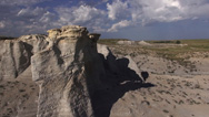
Towers of Chalk in Kansas
Amidst the flat plains of Kansas are the gorgeous remains of an ancient inland sea.
-

How Panama Changed the World
Two scientists scan islands off Panama for clues to determine how the country was formed.
-
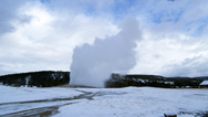
The Volcano Under Yellowstone
A giant cauldron of magma simmering beneath Yellowstone is threatening to blow.
-

How Water Is Reshaping the West
New dams and reservoirs are unmistakably altering the American West’s iconic landscapes.
-
What on Earth Made This?
In this geology quiz, test your knowledge of forces that shape beautiful and bizarre natural formations on our planet.
-

Hiding from Earthquakes
A simple yet apparently effective metamaterial could save vital buildings from earthquakes’ destructive waves.
-

Life's Rocky Start
What is the secret link between rocks and minerals, and every living thing on Earth?
-
Inside Glacial Lake Missoula
Find out what this vast Ice Age lake in the Pacific Northwest would have looked like before its catastrophic emptyings.
-

Bigger Than T. rex
Meet Spinosaurus—the lost killer of the Cretaceous and the world's largest carnivorous dinosaur ever.
-
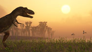
The Dinosaurs Were Not Alone
Explore a colorful cast of animals, plants, and insects that lived alongside the dinosaurs.
-
Earthquakes in the Midwest
Three massive earthquakes struck the American Midwest in 1811-12. Could it happen again?
-

Ice Age Death Trap
Scientists race to uncover a site in the Rockies packed with fossil mammoths and other extinct ice age beasts.
-
Australia: First 4 Billion Years
One of the strangest landscapes on Earth reveals our planet's complex history.
-

Mt St Helens: Back From the Dead
Thirty years after the massive eruption, could it happen again?
-
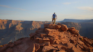
Time Travel in the Grand Canyon
What does this geological wonder reveal about North America’s deep history?
-

North American Gold
When the Earth formed, most of the gold sunk to its core—but some remained trapped inside Earth’s mantle.
-
These Boulders are Alive
Dive down to rare stromatolites—key clues to the evolution of virtually all complex life.

Major funding for "Making North America" is provided by the Alfred P Sloan Foundation.


National corporate funding for NOVA is provided by Draper. Major funding for NOVA is provided by the David H. Koch Fund for Science, the Corporation for Public Broadcasting, and PBS viewers.