GUEST: This was a map that has been in our family for over a century. It's been in my mom's house for over 50 years in the frame.
APPRAISER: It's what we would call in the trade a roller map. So when it was made, it was meant to hang on wooden dowels, and it would have been exposed to the light, and it has a little bit of varnish on it from that time. But that's to be expected with a wall map. There are very few institutional examples of this map. Perhaps because it was a wall map, not many survived. What you have is, you have the second edition. And we know that because it's dated in two places. It's dated in the lower, where it's copyrighted 1836.
GUEST: Mm-hmm.
APPRAISER: It was published by Colton. Your map was published in 1844. Another method for dating it is the progress of the Long Island Railroad.
GUEST: Mm-hmm.
APPRAISER: I think the 1836, the railroad only went to Mid-Island, as they call it, to Hicksville.
GUEST: Yes.
APPRAISER: Just a few years after that, which is the second issue, they made it all the way out to Greenport. So that speaks to the importance of the Long Island Railroad, which is one of the oldest railroads in the United States, and also of the development of Long Island. It shows the spine of Long Island, and it was formed by a glacier.
GUEST: Mm-hmm.
APPRAISER: So it's what's known as a terminal moraine. The North Shore of Long Island, or the Gold Coast, as you would call it...
GUEST: (chuckling)
APPRAISER: ...is hilly...
GUEST: Yes.
APPRAISER: ...and, and quite forested here. There's a lot of detail with elevations, swamps, marshes, and trees. So it's looking at nature and culture. And then you see lower, the South Shore is quite flat. It also has five insets here...
GUEST: Mm-hmm.
APPRAISER: ...which show the commercial connections between Long Island and other ports. There's New Haven, Connecticut...
GUEST: Mm-hmm.
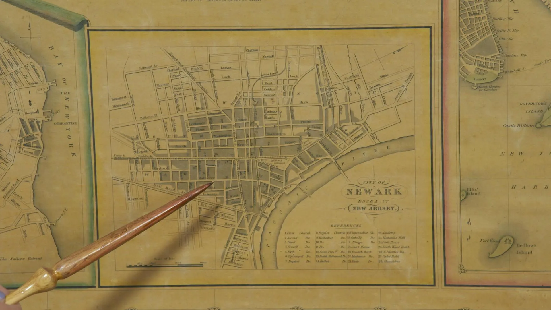
APPRAISER: ...and there's two references to Staten Island. I'm assuming for wha, the whaling industry. And then there's, uh, Newark, New Jersey, and then a wonderful inset of the Brooklyn Navy Yard.
GUEST: Brooklyn...
APPRAISER: So it's early for Long Island. There's a lot of Indigenous names-- Matinecock Point, and then got Shinnecock. And then also the Dutch connection, when they attempted to settle the Manhattan area back in the 17th century. The publisher made four editions of this map, and each edition showed the improvements of the Long Island Railroad.
GUEST: Mm-hmm. You referred to Matinecock, and the Matinecock Indians named that area Sint Sink, which was our first name of our peninsula. The Matinecock were able to sell off land to the English colonists and the Dutch, which is a part of our family.
APPRAISER: It was published in New York, and the surveyor was, uh, Calvin Smith, and it was actually printed in Lower Manhattan. It's one of the best maps of Long Island at the time.
GUEST: Great. It was our great-grandfather's, and apparently it was hanging in his office as a pull-down map, and it has a couple water stains because of the fire that was in the house in the early '60s.
APPRAISER: All the coloring is original color with watercolor...
GUEST: Yeah. Mm-hmm.
APPRAISER: ...and that's still intact. In a retail setting, I would estimate this to sell for between $5,000 and $6,000.
GUEST: Wow, that's very nice.
APPRAISER: It's a beautiful piece.
GUEST: Yes, but it is priceless.
APPRAISER: (laughs)

