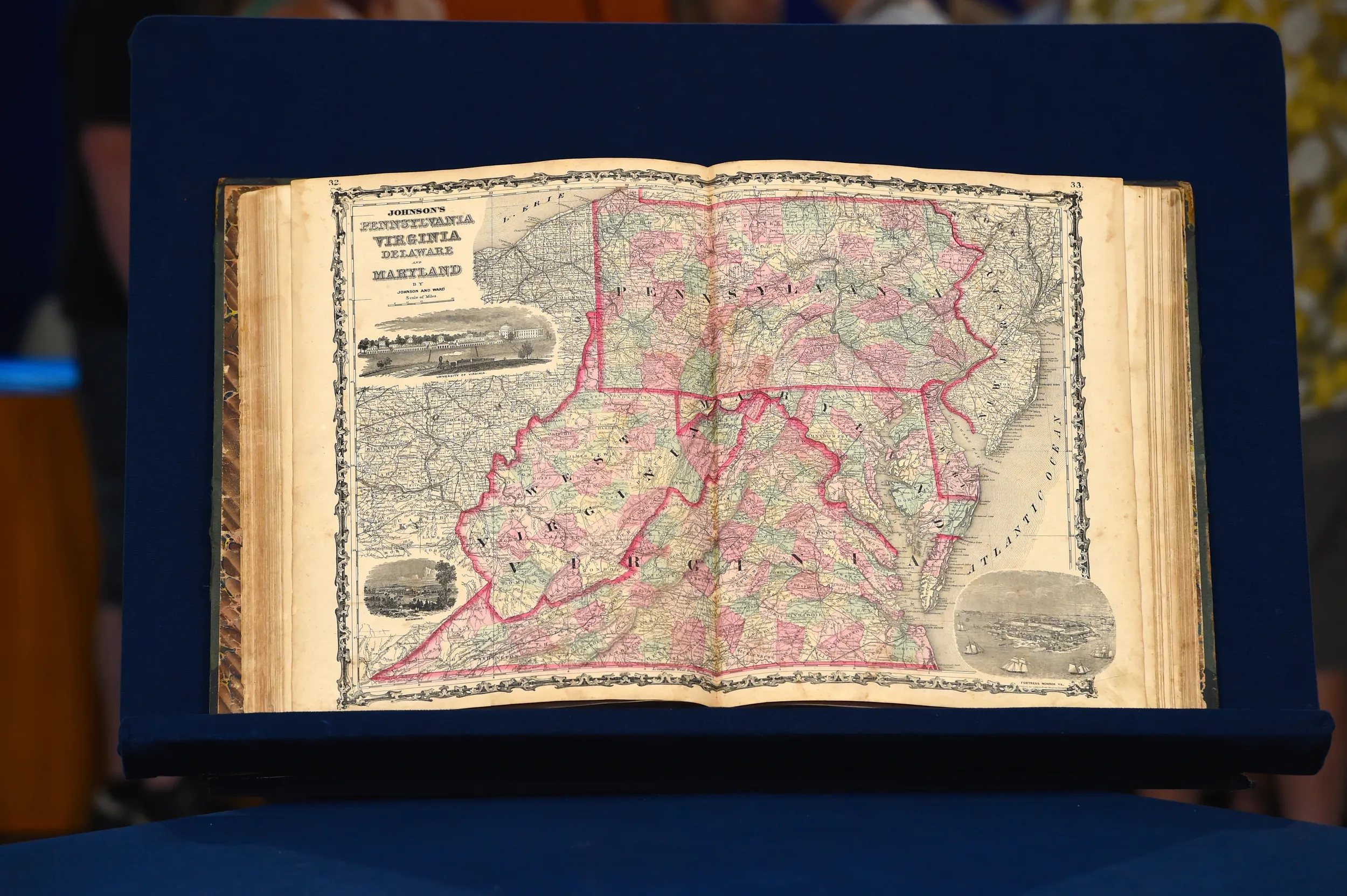
APPRAISER: You brought in this atlas, Johnson's Family Atlas, with the date 1863. Well, I think because we're here in Charleston, West Virginia, we wanted to look and see what, in 1863, a New York atlas was going to do with this part of the world. And so we went to the table of contents and we looked down here, and here is the state of Virginia on pages 32 and 33. And notice, in 1863, there is no West Virginia. And if we turn to the map, recognizing full well that things were in flux with this idea of having a new state. Here, in the map of the old dominion of Virginia and so on, on the Western end is this new state of West Virginia. But, there's still a label for Virginia well into West Virginia.
GUEST: Yes, I noticed that that crosses that state line.
APPRAISER: West Virginia became a state 1863, the same year that this atlas was made. The makers of this atlas just couldn't keep up with the changes as to what was Union territory, what was Confederate territory, but at the same time, they were recognizing Union territory, but nowhere in this atlas, except on a page with some flags, do they mention that there is a Confederacy. To do a map of the Confederacy, this was like recognizing the Confederacy. The editors could have been charged with treason, if you will, but this individual map is fascinating because it shows this development. It's one of the earliest maps of West Virginia. This is a poignant piece of West Virginia history. Do you know what was paid for this?
GUEST: It came down through our family. As I recall, my father had it, and before him, I'm not sure who had it.
APPRAISER: Uh-huh.
GUEST: And it just came down to me. I have no idea, whatever the price was in 1863. (laughs)
APPRAISER: Nowadays, I'd say an atlas like this is worth about $2,200 to $2,500, would be a very good retail price for this.
GUEST: Very good.
APPRAISER: Depending on condition, and this one is in very good condition.
GUEST: Okay.
APPRAISER: So you've got a fine piece here.
GUEST: Well, thank you.

