Deadliest Volcanoes
From Japan's Mt. Fuji to Yellowstone's buried supervolcano, how can we best prepare for the most lethal eruptions? Airing January 4, 2012 at 9 pm on PBS Aired January 4, 2012 on PBS
Program Description
Transcript
DEADLIEST VOLCANOES
PBS Airdate: January 4, 2012
NARRATOR: Volcanoes: one of nature's most powerful forces and one of its greatest mysteries. There are more than 1,500 active volcanoes around the globe. Half a billion people live in their shadows and under constant threat. From the U.S.,…
HENRY (HANK) HEASLER (Yellowstone National Park): Yellowstone is one of the world's largest active volcanoes.
NARRATOR: …to Europe, to Asia, the potential for a deadly eruption is very real. But what's actually happening deep below the surface? What causes them to erupt? Can we predict when they will explode or how big an eruption will be? Each volcano is unique. There is no single approach that can unlock all of their mysteries.
These are the challenges facing scientists, but now, new technologies are opening up the earth like never before.
ROBERT (BOB) SMITH (University of Utah): So we can construct a three-dimensional picture, like an M.R.I. scan or a CAT scan.
NARRATOR: Scientists use invisible gases and volcanic springs; they measure minute movements of the earth; and they're using rays from space, all in an effort reveal the secrets of the earth's Deadliest Volcanoes: up next on NOVA.
The tiny island nation of Vanuatu, located in the Pacific Ocean: this is Ambryn, one of the world's most active volcanoes. Explorer Geoff Mackley is about to risk his life and climb into the half-mile-wide crater, above a seething lake of molten rock.
GEOFF MACKLEY (Explorer): Well, we're hanging on the side of a cliff, about a mile high, and just down below us is a furiously boiling lava lake. And it's incredible: the noise is unbelievable; the heat—there's just waves of heat that you can feel even from here. Amazing.
NARRATOR: Heat rising from the depths of the earth reaches almost 2,000 degrees Fahrenheit, hot enough to turn solid rock into liquid magma.
GEOFF MACKLEY: The energy required to boil rock and throw it through the air like water? Mother Nature: it's the ultimate show.
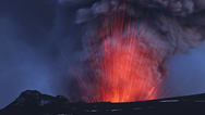
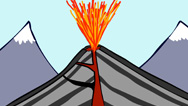
NARRATOR: But what exactly triggers these eruptions? The answer lies several miles below the surface, in the magma chamber, a vast reservoir of partially molten rock. Magma contains gases at very high pressures. As it rises up into the chamber, the pressure builds. When the pressure gets too great, magma pushes through the rock and explodes through the surface, causing an eruption capable of throwing magma thousands of feet into the air.
In the past two centuries there have been over 200,000 deaths from volcanic eruptions around the globe and many thousands of injuries including the 2010 eruption of Mount Merapi, in Indonesia, that killed more than 200 people and forced a hundred thousand more to flee.
With so much at stake, can scientists predict when these eruptions will occur and how big they will be? It's not only lives that are in danger; national economies face crippling losses.
Iceland, April 2010: a volcano called Eyjafjallajokull throws a giant ash cloud 30,000 feet up and over 2,000 miles away, covering large parts of Europe. Scientists here see this one coming, but its size and impact take them completely by surprise.
A few months before the eruption, scientist Sigrún Hreinsdóttir installs a new generation of G.P.S. sensors around Eyjafjallajokull.
SIGRúN HREINSDóTTIR (University of Iceland): It's not the nicest road in Iceland.
NARRATOR: She tracks the sensors' position using satellite G.P.S. They're so sensitive they can measure a change in position to within an eighth of an inch.
She wants to see how magma moves underground. If she can detect it moving towards the surface, it could indicate an eruption is on the way. But the magma is thousands of feet down, so she measures the way a point on the ground travels. If magma starts to move, it will cause the ground above it to move, too.
The idea is that if magma moves into a volcano, it will push the ground outward, which the G.P.S. sensors will be able to pick up.
SIGRúN HREINSDóTTIR: We installed this station, and, first, we didn't see much. But it started showing odd behaviors. It started moving up and down and north and south, like, centimeters a day, which is very unusual.
And this behavior...I thought, "This station must be unstable."
NARRATOR: By the beginning of March, 2010, all the G.P.S. stations move away from the center of the volcano. Dr. Hreinsdóttir realizes that the movement must be caused by a large amount of magma moving up through the earth's crust and pushing the ground sideways. On March 4th, she becomes concerned an eruption is on the way.
SIGRúN HREINSDóTTIR: I got nervous. I have to say we got nervous. We had a meeting with the authorities of Iceland, and they raised the alert level.
NARRATOR: Then, on March 20th, 2010, the volcano erupts. It starts out as a beautiful but harmless event, but over the next three weeks, that changes. It erupts more explosive magma, which mixes with ice on top of the volcano, creating huge clouds of ash.
Video captures lightning discharging from inside the cloud, the result of ash particles creating electric sparks. The cloud rises 30,000 feet into the air. Ash spews into the air at a rate of 200 tons per second, carried by the wind, right across the heart of Europe, at the same altitude used by commercial airliners.
Volcanic ash can destroy aircraft engines. For more than a week, air traffic across Europe is brought to a near standstill. The United States is cut off from most of Europe. Thousands of transatlantic travelers are left stranded.
This isolated spot in the North Atlantic, hundreds of miles from Europe or the U.S., causes the worst airline disruption since 9/11. The total cost is over two billion dollars.
G.P.S. technology allowed Dr. Hreinsdóttir to observe the volcano waking up, but it couldn't tell her how big the eruption was going to be.
SIGRúN HREINSDóTTIR: I really got a shock when I realized what this volcano had done. I thought it would be a little "poop," and then we would, yeah, enjoy the data. But, there were surprises at each corner.
NARRATOR: This is one of the challenges facing scientists. Every volcano is unique, and different techniques are needed to unlock their secrets. And there are some places where understanding a volcano's behavior is more urgent than ever.
Yellowstone National Park, Wyoming: this magical place is a major tourist attraction, a home to strange-colored pools and otherworldly rock formations, and geysers, like Old Faithful, which regularly spits 200-degree water over 100 feet into the air.
But the beauty masks a powerful force that could threaten life across the planet. Yellowstone is a supervolcano.
HANK HEASLER: Yellowstone is one of the largest active volcanoes. Most people, when they visit Yellowstone, don't realize that, because there's not the steep peak associated with most volcanoes. But behind me, here, you have some of the evidence for the active volcanism of Yellowstone.
NARRATOR: One of the greatest mysteries surrounding the Yellowstone supervolcano is its location. The world is made up of giant plates of rock, called tectonic plates. Most of the world's volcanoes lie on the edges of or between these plates, where it's easier for magma to form and reach the surface.
The most active edges are the ones surrounding the Pacific Ocean. This is the "Ring of Fire." It includes some of the most populated countries on Earth, including Indonesia, Japan and the U.S.A. Three-quarters of the world's active volcanoes are on the Ring of Fire.
But Yellowstone is different. It isn't on the edge of a plate. It's right in the middle of one, the North American plate. How can there be a volcano here, so far from a plate boundary?
We know, from looking at the rocks of Yellowstone, that the volcano has been active for a long time. Two million years ago, Yellowstone produces one of the largest eruptions ever seen on the face of the earth. It blasts away the peaks we normally associate with volcanoes and leaves this strange flattened landscape.
Yellowstone hasn't had a major eruption on this cataclysmic scale for over 640,000 years, but the hot springs and geysers are signs that there's a lot of heat under the surface.
This volcano is very much alive, and it is intensely monitored. Here, seismometers are vital.
Bob Smith is the scientist in charge.
BOB SMITH: I'm opening the lid, this is going to fall down, of a seismic vault. And inside is a seismometer, which sends a signal on to a telemetry network. And that antenna is pointed to a receiver about 20 miles down, on the lake. So anything that we're doing right now, it's recorded right now, on my computer at Salt Lake City, as are the entire seismic and G.P.S. networks.
NARRATOR: The easiest way underground magma reaches the surface is through a channel, created by fracturing the rock above it. As the rock cracks, it creates vibrations, small earthquakes that occur days or weeks before an eruption. It's these vibrations that seismometers detect.
Smith is confident that the seismometers will give some kind of warning of the next eruption, but when that might happen, no one knows. At the moment, there's no major increase in activity. Yellowstone is sleeping.
But scientists also use these earthquakes and G.P.S. to reveal what's inside the volcano and solve the mystery of why Yellowstone is here, in the middle of North America.
BOB SMITH: The seismographs do two things: they record the earthquakes that are active, and then they're used to scan the subsurface that we can't otherwise see.
NARRATOR: Seismic waves travel faster through cold, solid rock and slower through hot, molten rock. As seismic waves from distant earthquakes travel through underground magma reservoirs, they slow down. By measuring the waves at multiple points, it's possible to build up a three-dimensional picture of where the magma underneath Yellowstone is located.
BOB SMITH: We can construct a three-dimensional picture, like an M.R.I. scan or CAT scan, by recording thousands of earthquakes into our array of seismographs.
NARRATOR: The seismic network at Yellowstone is extensive, with over 150 seismometers, spread out over 100,000 square miles.
Bob Smith is able to look deeper than ever before, hundreds of miles down. And what he's discovered is striking: a huge structure of partly molten rock beneath Yellowstone.
This is a mantle plume, a rising column of magma, stretching at least 400 miles into the earth.
HANK HEASLER: This is the same concept as a lava lamp. You heat up the wax in the base, over a bulb, and then it slowly rises up because it's less dense. That's the basic concept for a mantle plume.
NARRATOR: For scientists, seeing this for the first time is a breakthrough. It solves the mystery of why the Yellowstone volcano is here. This plume is powerful enough to force its way through the middle of the North American plate and create a volcano where there wouldn't normally be one.
HANK HEASLER: Are there eruptions in Yellowstone's future? Definitely. Now, will there be another catastrophic eruption? That we don't know.
NARRATOR: A major eruption would be cataclysmic.
BOB SMITH: What it would create would be massive volumes of material. It probably goes on for days and weeks and months. And it's destroying all the surface rocks, if you wish, in its path.
NARRATOR: Most of the western United States would be buried in thick ash deposits, capable of collapsing buildings and suffocating people. Hurricane-force flows of superheated gas and ash would blast out, covering a 2,000-square-mile area. A towering column of choking ash cloud would rise 25 miles up into the atmosphere, blocking out sunlight across the planet. Temperatures would plummet, crops would fail and millions of people would die of starvation.
The awesome power of such an eruption, equivalent to the force of a thousand Hiroshima bombs every second, is impossible to defuse. All we can hope for is a warning, a chance to prepare as best we can.
BOB SMITH: There's no way to know when an eruption is occurring in the future. Could happen today, tomorrow, thousands of years from now. We simply don't know where we are in these cycles. That's why the instruments are so critical.
NARRATOR: As scientists keep a watchful eye on Yellowstone, on the other side of the Atlantic there's a volcano that could pose an even greater threat.
Many experts believe the place where people are most at risk from volcanoes is here: Naples, in Italy. This is one of the most densely populated cities in Europe. Three million people live here, and it lies at the foot of the most famous volcano on Earth: Vesuvius.
At 4,200 feet high, Vesuvius towers over the city. It has erupted over 25 times in the last 2,000 years, the most deadly eruption was in 79 A.D., when it buried the town of Pompeii, killing thousands. They had no warning, no time to run.
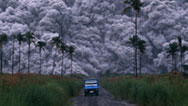
If it were to erupt today, the effects would be devastating. Burning clouds of ash and gas, called a pyroclastic flow, would wipe out large parts of the city. Over half a million people are at direct risk.
Scientists keep a very close eye on Vesuvius. They watch for any seismic signals that magma is escaping from the magma chamber. They're confident that will give them at least a few days warning before Vesuvius erupts.
And now, scientists are using a brand new technique to help them predict how large an eruption could be. Inside a volcano is a tube, the "throat" of the volcano. It's the structure through which magma flows, in an eruption, to the surface. The larger the tube, the more magma flows through it, and the bigger the eruption is likely to be.
Until now, there's been no way to see inside a volcano. Not even X-rays are any use; they can't penetrate solid rock.
But, surprisingly, the solution is found in events happening thousands of light years away, in deep space.
Dr. Hiroyuki Tanaka is harnessing the power of the universe. Far out in the cosmos, violent explosions of stars send out particles, flying at enormous speed. They're called cosmic rays. These fly across space, and some of them hit the earth. When these rays hit the upper atmosphere they create a shower of invisible particles. Dr. Tanaka is interested in the ones called "muons."
HIROYUKI TANAKA (University of Tokyo): Muons are from everywhere, from this direction, from that direction or from vertical or horizontal. The muon's penetration is very strong, so that building, that building or that building, are almost transparent for a muon to penetrate.
NARRATOR: Here is something powerful enough to pass right through thousands of feet of solid rock. They can even pass through whole mountains. Dr. Tanaka has a brilliant idea: perhaps they can be used to create an image of the inside of a volcano.
He builds a device that detects the naturally-occurring muons. At the heart of the device is a special kind of plastic.
HIROYUKI TANAKA: When the cosmic muon arrives, this device, this device makes a very faint blue light.
NARRATOR: These blue lights are picked up by a light sensor which converts them into an electric current that a computer can analyze. Tanaka places these muon detectors around a volcano.
As the muons pass through the volcano, some are absorbed. But where the rock is less dense, more muons pass through. These muons are picked up by the detector and form an image of what's inside the volcano. By placing detectors at different points, it's possible to build a 3-D image.
His first target is Mt. Asama. This is one of Japan's most active volcanoes, and it lies just 90 miles from Tokyo.
He leaves the detectors in place for months to collect enough muons. This has never been tried before. It may not work, but if it does, it could revolutionize prediction, by revealing the inner structure of a volcano.
Tanaka sees the first image.
HIROYUKI TANAKA: I was very skeptical. In order to validate, I tried many things. Finally, I found that it was true. Everybody was excited, so that was a very, very exciting moment for me, too.
NARRATOR: The image is crude, but it reveals the structure of the volcano. The red is the dense rock of the volcano cone. In the middle is a hole, the throat of the volcano, visible for the first time. It proves the technique works and reveals the size of the throat, critical for predicting the size of an eruption.
Tanaka used these images to correctly predict information about Mt. Asama's recent eruption. By measuring the size of the throat and changes in density, he's able to track the movement of the magma. In this case, he calculates how much magma will reach the surface as well as where it's located.
Tanaka's revolutionary new technique is now being tested on Mt. Vesuvius. It is the first volcano outside Japan to be analyzed with muons. It could give the people of Naples a warning of what Vesuvius has in store.
But here in Naples, the scientists are fighting a battle on two fronts. Vesuvius is just the tip of the iceberg. There's a hidden danger lurking beneath the ground, and the clue is in these ruins.
This is the marketplace of Serapeo. It was built almost 2,000 years ago, but something strange has happened since then. Ten feet up the columns is a dark band, where marine mollusks burrowed into the rock. These creatures only live under water, which means this building was once submerged.
CHRISTOPHER KILBURN (University College London): Just standing here, we have remarkable evidence of the fact that the land must have subsided into the sea and come back up out again, at least once in the last 2,000 years, or so.
NARRATOR: What could be causing the ground to rise and fall? It's not just the temple. The whole region is lifting, including entire towns. And the movement is going on today. Since the 1970s the ground has lifted up by almost 10 feet. In the port, these boat ramps were once under water; they're now high and dry.
And just outside the town is a place that reveals the cause of this movement. Here, superheated steam and sulfurous gases burst out of the ground. The evidence is clear; this entire area is one giant volcano, containing farms, villages, whole towns within it.
CHRISTOPHER KILBURN: You know our view, here, there are probably a hundred thousand people in the houses we can see, and…most of whom, perhaps, are not completely aware that they're actually living in the heart of an active volcano. Psychologically, it's difficult to get that message across, because there's no physical evidence of danger.
NARRATOR: With no obvious cone, like the one at Vesuvius, the scale of the volcano is only clear from above. The entire picturesque bay is, in fact, a giant volcanic crater, eight miles across. It's called Campi Flegrei.
Using the movement of the ground, scientists calculate that there's a huge magma chamber under the bay.
Thirty nine thousand years ago, this volcano erupts. Billowing columns of hot gas and magma spew from the magma chamber. As the chamber empties, the pressure lowers and the ground above it sinks down. It forms a large bowl-shaped depression called a "collapsed caldera," similar to the shape of Yellowstone. Eventually, the sea floods, forming the bay we see today.
It is the largest eruption Europe has seen in the last 100,000 years. If Campi Flegrei ever erupts on the same scale as the prehistoric eruption, the effect would be devastating. Pyroclastic flows would flood out, destroying everything in the vicinity. If they weren't evacuated, millions would die instantly. Ash would spread out across the whole of Europe, triggering climate change that could last for decades.
Now researchers are about to embark on a bold project to find out what's actually happening underground. Muon scanning won't work for a flat volcano like Campi Flegrei, so their plan is to drill right into it.
The scientist in charge is Giuseppe De Natale.
GIUSEPPE DE NATALE: This is an old steel factory, now abandoned. The drilling place will be just here, around.
NARRATOR: They intend to drill a hole over two miles deep. They're hoping to get a sample of rock from right inside Campi Flegrei. The drill will curve under the bay, toward the heart of the volcano.
And they hope that rock samples will help answer a crucial question: is it magma causing the ground to lift up or just gas and heated water?
CHRIS KILBURN: One of the objectives of the deep drilling project that's about to start is that we might be able to resolve the debate about whether the fluids that have been accumulating at three kilometers depth are, in fact, magma or are they heated water or some other fluid.
NARRATOR: Settling this debate is critical for predicting the risk of an eruption. If Chris Kilburn is right, and it's magma, building up two miles underground, causing the uplift, there could be a devastating eruption. Others think it's more likely that gas and heated water inflate the ground, like a balloon.
CHRIS KILBURN: Now, if that's the case, the potential for an eruption is actually quite low, because all that's accumulating is water and hot gases. The alternative, that it's magma accumulating, suggests the possibility of an eruption is higher.
NARRATOR: Analyzing rock samples from the volcano itself tells the people of Campi Flegrei whether the volcano they're living on is heading for an eruption.
GIUSEPPE DE NATALE: This experiment will allow us not only to understand much better this kind of volcano, but also to understand how to forecast the next eruption.
NARRATOR: This project is only just beginning, and scientists are years away from fully understanding Campi Flegrei, but nearby, scientists find what might be the Holy Grail of accurate prediction.
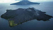
One hundred fifty miles from Campi Flegrei, in the Mediterranean Sea, is Stromboli. This island is one big volcano, rising from the sea. It's erupting, as it's done every day for at least 2,000 years.
But without warning, the volcano can change. It can suddenly become more explosive, sending blocks of lava, five feet across, flying through the air. For the thousands of tourists who visit the volcano each year, these explosions can be deadly.
Volcanologist Alessandro Aiuppa is responsible for the safety of the visitors. He knows the only way to protect them is to predict the violent explosions.
ALESSANDRO AIUPPA (University of Palermo): What we have been looking for is precursory signals in the hours or in the days prior to the explosion itself.
NARRATOR: Aiuppa focuses on the volcanic gas that causes these explosions. Deep underground, the magma is at such high pressure that gases actually dissolve in the molten rock. But when the magma rises, the pressure goes down and the gas is released. It's like a bottle of soda.
ALESSANDRO AIUPPA: If you have a capped bottle of soda, you don't see any gas bubbles here, because the gases will be dissolved into the soda. And at the same time, if you think of the magma deep in the crust, all the gases will be dissolved into the magma. But as soon as you remove the cap, all the gases will be going out of your bottle and this is more or less the same as what is happening as the magma is being decompressed, as it is ascending through the crust, up to the surface.
NARRATOR: As the magma starts to rise from deep underground, it releases gases. Aiuppa wants to find out whether the amount of gas released by the volcano might give a warning of a larger violent explosion.
One of the gases released is the deadly sulfur dioxide. But sulfur dioxide is invisible, so how can you measure it? The answer is a new type of camera.
ALESSANDRO AIUPPA: So we…what they do is that they take images of the gas plume, but they are working in the U.V. region.
NARRATOR: In normal light, there's just a wisp of steam, but with the U.V. camera, the plume of sulfur dioxide is clearly visible, in red and yellow.
Aiuppa also measures another gas: carbon dioxide, CO2, one of the most common volcanic gases.
Unfortunately, CO2 is impossible to measure remotely, because the atmosphere contains naturally-occurring CO2 which interferes with the measurement. The only way to detect it is with instruments at the summit. Scientists have to climb right to the rim of the crater, even when the volcano is in a state of high alert.
This is the device that detects CO2 and continually transmits the reading down to the control center.
Aiuppa measures the two gases for over five years, looking for a change that happens before an explosive eruption. He notices a pattern.
ALESSANDRO AIUPPA: What we have seen is that 12 of the last 14 major explosions have all been preceded by CO2 increases.
NARRATOR: Aiuppa's theory is that the normal small explosions are caused by sulfur-dioxide-rich bubbles that form at low pressure, but the big deadly explosions are caused by magma, rich in CO2, that bubbles out deeper down, at much higher pressure. When CO2 starts appearing, a dangerous event is on the way.
The theory has recently been put to the test. In May, 2010, the level of CO2 increases. Aiuppa recommends that the volcano be closed to tourists.
ALESSANDRO AIUPPA: The volcano is an attraction, so it's a big responsibility. But on the other hand, you know that if the volcano is creating major explosions, and tourists are up there, that's a dramatic event which we really want to avoid.
NARRATOR: Just a few days later, the volcano explodes. If it hadn't been closed, visitors to the island might have been killed.
For Aiuppa and his team, it's a triumph. Not only have they predicted when, but just as importantly, they knew how large this eruption was going to be.
Could this technology be the breakthrough scientists have been waiting for?
ALESSANDRO AIUPPA: When you close the volcano and then you have the explosion, you feel so excited, because you understand what we are doing is not theoretical science, but it has such important practical implications. You may be saving human lives.
NARRATOR: But different volcanoes give off different signals. Scientists don't yet know if all volcanoes emit an increase in CO2 before a large eruption. This is why they use many different techniques to predict eruptions.
And nowhere is that more important than in the shadow of one volcano, here in the United States.
Washington State: 50 miles south of the city of Seattle is Mt. Rainier. It dominates the lands around it, a beautiful and seemingly peaceful mountain, but it's a potential killer.
It's part of the same range as Mt. St. Helens, which, in 1980, exploded with huge force, killing 57 people and causing over a billion dollars' worth of damage. A similar-sized eruption of Mt. Rainier would be far more deadly, because of the much larger population around the mountain.
But the biggest risk comes, not from an eruption itself, but from what it unleashes. This is a "lahar," one of the most dangerous hazards that volcanoes produce. It's a churning avalanche of volcanic mud, rocks and water. In 1985, the Nevado Del Ruiz volcano, in Columbia, erupts. Within hours, it unleashes a lahar that swallows a town of 28,000 people. Most of them are buried or swept away. It is one of the deadliest eruptions in history.
Mt. Rainier has more snow and ice on its summit than any other mountain in the lower 48 states. If this ice comes into contact with hot lava, it rapidly turns into a torrent of mud.
One of the towns most in danger is Orting. Six thousand people live here, at the base of Mt. Rainier, and the population is expanding. It's a risk Jody Woodcock, a public safety official for the county, is all too aware of.
JODY WOODCOCK (Pierce County Emergency Management): What we're looking at, in the city of Orting, is potentially 20 to 30 feet of mud. That flowing concrete could actually travel up to 40, even 50 miles an hour and could ultimately destroy everything in its path.
NARRATOR: And it's not just Orting that's at risk. Geologists have found evidence for many lahars from Mt. Rainier, going back thousands of years. The volcano produced some of the largest mudflows ever seen on the face of the earth. Some reached as far as the present day City of Tacoma and even created floods that entered the outskirts of Seattle, 60 miles away. It's been quiet since 1882.
The pressure is on scientists to forecast the next eruption of Mt. Rainier. Like other volcanoes, it's monitored with G.P.S. and seismometers to warn of ground movement caused by magma flowing underground. But Steve Ingebritsen is searching for another way to predict eruptions, using water.
STEVEN INGEBRITSEN (U.S. Geological Survey): It's about 18 degrees here.
Clive, are we going to walk around a little bit?
NARRATOR: Normally, a mountain stream would be less than 40 degrees Fahrenheit, but the water here is 70 degrees.
STEVE INGEBRITSEN: Well what's interesting about this stream that you wouldn't give a second glance to if you were hiking—you might actually take a drink out of it—is that there is chemical and thermal evidence of deep volcanic fluids effecting it.
NARRATOR: These deep volcanic fluids could be magma or volcanic gas. Scientists don't know exactly how it happens, but somehow the heart of the volcano, over six miles down, is heating up the water near the surface.
STEVE INGEBRITSEN: How did this water come to be a bit warm and have these funny chemicals in it? That's something we would really like to know more about. I think that's one of the great unknowns in these systems.
NARRATOR: Scientists hope the water gives them a clue that the volcano is waking up.
At Mt. St. Helens, before the eruption of 1980, there are reports of the streams getting warmer and even changing color.
It seems these streams could be giving us a vital warning, but one that's been missed by scientists in the past.
STEVE INGEBRITSEN: Oh, that looks like a nice place, too.
NARRATOR: To make sure it's not missed again, Steve Ingebritsen is installing a new kind of sensor into the streams here on Mt. Rainier.
STEVE INGEBRITSEN: This probe will record water pressure, electrical conductivity of the water and temperature of the water, for five to seven years, at hourly intervals, with internal storage and internal power.
We're calling this site "Terror Dice" right, Bob?
NARRATOR: Ingebritsen and his team install these sensors, not just onto Mt. Rainier, but on volcanoes all along the Cascade Range. Their work is so new, they don't yet know just what kind of warning the sensors will give them. But it could be a valuable new weapon in the battle to predict eruptions.
STEVE INGEBRITSEN: We definitely hope these sorts of water features are going to tell us something about what's going on deep in the volcano.
NARRATOR: But even if science can predict the next eruption, the people of Orting are still at risk. There's enough unstable rock on the volcano to form a lahar, even without an eruption. A rock slippage at the summit could be enough to trigger one, and if that happens, there could be little warning. The only hope is to escape to higher ground in the minutes before the lahar hits.
An alarm system is installed to give them a chance.
JODY WOODCOCK: The keys to the lahar warning system are the sensors, or what we call "acoustic flow" monitors. There's five on each upper river valley. What these do is detect ground vibration.
NARRATOR: Lahars make a very distinct kind of vibration that tells the system a mudflow is on its way.
JODY WOODCOCK: Once the acoustic flow monitors pick up activity, the siren that you see behind me, and those throughout the rest of the valley, will be activated immediately.
NARRATOR: This is the first automated lahar warning system installed anywhere in the world. But even with the alarm, it's a huge challenge to get everyone out in time.
JODY WOODCOCK: The city of Orting has approximately 40 minutes to evacuate. So it really doesn't allow much time, and we have to be ready to act swiftly.
NARRATOR: In the last few years, scientists have found new ways of uncovering the secrets hidden inside volcanoes. They've made great advances in accurately predicting volcanic eruptions. In some cases, they can tell, not just when, but how big an eruption will be.
But there are some volcanoes that are so powerful they could devastate the whole planet. For now, all we can do is hope that they stay quiet for many years to come.
Broadcast Credits
Deadliest Volcanoes
- Written and Directed by
- Nathan Williams
- Edited by
- Justin Amsden
David Dillon
Ben Harrison
- Series Producer
- Yavar Abbas
- Camera
- Ben Hodgson
Wade Muller
Robin Probyn - Sound Recordists
- Darrell Briggs
Adam Butler - Narrated By
- Craig Sechler
- Music
- Justin Nicholls
- Animation
- Weave
- Production Manager
- Nikki Tilley
- Production Assistants
- Bridie Bischoff
Rosie Colman
Louise Troen - Online Editor
- Adriano De Mello
- Audio Mix
- Matt Faulkner
- Assistant Producer
- Lizzie Abbott
- Archival Material
- Ágúst Guðbjörnsson
America by Air
AP Archive
Artbeats
Department of Defense
ESA/Hubble
Framepool
Roberto Haruo Katayoshi
ITN Source
David Lea
Geoff Mackley
NARA
NASA
Orting School
PAHO Archives
Photolibrary (OSF)
Pioneer Productions
James Reynolds
Tropical Visions
U.S. Geological Survey - Special Thanks
- Páll Einarsson
Jamie Farrell
Agust Gudmundsson
Marcello Martini
Andrew McGonigle
Bill McGuire
Mount Rainier, National Park Service
National Park of Vesuvius
Patrick Pringle
Nick Petford
City of Pozzuoli
Tom Sisson
Paolo Strolin - For Pioneer Productions
- Executive Producer
- Stuart Carter
- Head Of Development
- Jeremy Dear
- Head Of Production
- Kirstie McLure
- Head Of Finance
- Peter Dunkerley
- NOVA Series Graphics
- yU + co.
- NOVA Theme Music
- Walter Werzowa
John Luker
Musikvergnuegen, Inc. - Additional NOVA Theme Music
- Ray Loring
Rob Morsberger - Post Production Online Editor
- Spencer Gentry
- Closed Captioning
- The Caption Center
- Marketing and Publicity
- Karen Laverty
- Publicity
- Eileen Campion
Victoria Louie - Senior Researcher
- Kate Becker
- NOVA Administrator
- Kristen Sommerhalter
- Production Coordinator
- Linda Callahan
- Paralegal
- Sarah Erlandson
- Talent Relations
- Scott Kardel, Esq.
Janice Flood - Legal Counsel
- Susan Rosen
- Director of Education
- Rachel Connolly
- Digital Projects Manager
- Kristine Allington
- Director Of New Media
- Lauren Aguirre
- Associate Producer Post Production
- Patrick Carey
- Post Production Editor
- Rebecca Nieto
- Post Production Manager
- Nathan Gunner
- Compliance Manager
- Linzy Emery
- Development Producers
- Pamela Rosenstein
David Condon - Business and Production Manager
- Jonathan Loewald
- Senior Producer and Project Director
- Lisa Mirowitz
- Coordinating Producer
- Laurie Cahalane
- Senior Science Editor
- Evan Hadingham
- Senior Series Producer
- Melanie Wallace
- Executive Producer
- Howard Swartz
- Managing Director
- Alan Ritsko
- Senior Executive Producer
- Paula S. Apsell
Image
- (erupting volcano)
- © bierchen/Shutterstock
Participants
- Alessandro Aiuppa
- University of Palermo
- Giuseppe De Natale
- INGV Observatory of Vesuvius
- Henry Heasler
- Geologist, Yellowstone National Park
- Sigrun Hreinsdottir
- University of Iceland
- Steven Ingebritsen
- U.S. Geological Survey
- Christopher Kilburn
- University College London
- Geoff Mackley
- Explorer
- Robert Smith
- University of Utah
- Hiroyuki Tanaka
- University of Tokyo
- Jody Woodcock
- Deputy Director, Pierce County Emergency Management
Preview
Full Program | 52:45
Full program available for streaming through
Watch Online
Full program available
Soon

