 |
 |

|
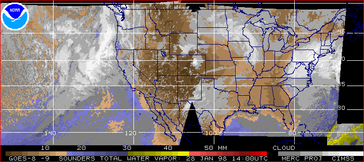
A Winter Soaker January 28, 1998 
Storms along the west and east coasts of North America on January 28, 1998. Composite satellite image of total precipitable water vapor (the amount of liquid water, in millimeters, if all the atmospheric water vapor in the column is condensed) Browns is the driest, red is the most moist, and clouds are represented in gray. You can see the most recent images at the Cooperative Institute for Meteorological Satellite Studies web site at the Space Sciences Engineering Center at the University of Wisconsin-Madison. (back) Satellite image: NOAA/CIMSS/University of Wisconsin-Madison. Anatomy of El Niño | Chasing El Niño | El Niño's Reach Dispatches | Resources | Mail | Site Map | El Niño Home Editor's Picks | Previous Sites | Join Us/E-mail | TV/Web Schedule About NOVA | Teachers | Site Map | Shop | Jobs | Search | To print PBS Online | NOVA Online | WGBH © | Updated November 2000 |