 |
 |

|
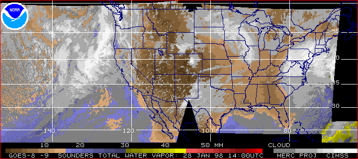
A Winter Soaker January 28, 1998 By Mark Hoover previous | next There's a strong Pacific storm moving into the northwest US and British Columbia tomorrow, a classic El Niño winter soaker that's going to add another couple of inches of rain to the swollen total so far this year, and there's no end in sight.
In fact, the storms have been as regular as a metronome this winter. The persistent low pressure center south of Alaska has been kicking out a new one every three to five days. Meteorologists call this storm-making process cyclogenesis. What they mean is that cold polar air interacts with relatively warm updrafts from the ocean, spinning up cyclone after cyclone. The northern jetstream, which has been pushed farther north than usual this year by El Niño, then conducts these north Pacific storms with regularity to their landfall, the Pacific northwest. There are two jetstreams involved in our weather in the middle latitudes, the northern and the southern. The southern jet is also displaced north, and has been bringing a lot more warm air, heavily charged with tropical moisture, into the US this winter. Normally this air would stay south of the continental US. The wet warm air has been clashing with colder Canadian air, and setting up eastern storms. The very large storm off the Atlantic coast right now shows what can happen when all that El Niño moisture starts condensing out into a storm center. On this morning's real-time GOES satellite image, you can see these two storms clearly. You are looking at El Niño's handiwork. East and west, the US is being squeezed by the teleconnected effects of a large pool of warm water off the coast of Peru. Look for the pattern again this winter. You will see it often. Check back tomorrow for an update on the next Pacific storm as it enters "the chute," and the next opportunity for StormFlight. previous dispatch | next dispatch | table of contentsSatellite image: NOAA/CIMSS/University of Wisconsin-Madison. Anatomy of El Niño | Chasing El Niño | El Niño's Reach Dispatches | Resources | Mail | Site Map | El Niño Home Editor's Picks | Previous Sites | Join Us/E-mail | TV/Web Schedule About NOVA | Teachers | Site Map | Shop | Jobs | Search | To print PBS Online | NOVA Online | WGBH © | Updated November 2000 |
