|
|
| ||||||||||||
|
|
 |
|
|||||||||||||||||||||||||||||||||||||||||||||||
|
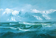
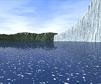
The great continental ice sheets were melting very fast in the time of Glacial Lake Missoula, shedding great torrents of meltwater every summer, raising sea level an average of approximately 100 feet every 1,000 years. Meltwater swept enormous volumes of sediment just freed from the melting ice into every low place it reached. The glacial lakes got their fair share. All glacial lakes, ancient and modern, deposit distinctive sediments unlike those laid down in any other setting. A brilliant greenish blueMoving glaciers grind together the rocks frozen within them, pulverizing them into powdery rock flour, which is generally very pale gray, almost white. The warmth of the long summer afternoons of the most recent ice age sent great freshets of glacial meltwater, milky white with suspended rock flour, into Glacial Lake Missoula. Rock flour settled through the murky water and deposited as a layer of pale sediment on the floor of the lake. Those pale summer layers varied in thickness from a fraction of an inch to as much as two inches or even more. Meanwhile, the suspended rock flour enriched the lake in dissolved mineral nutrients, making an extremely fertile environment for algae and the long food chain of animals that depend on them. Algae bloomed in the sunlit shallows of summer, making a rich organic soup. Then the cooling weather of fall stopped the glacial meltwater and cut off the supply of rock flour. After the winter freeze killed summer's algae and microscopic life, their remains slowly settled into a layer of sediment dark with organic matter, the color of dark chocolate, on the lake floor. Those winter layers also range in thickness from a fraction of an inch to as much as two inches or occasionally more. Geologists call the layers of light and dark sediment laid down on the floors of glacial lakes varves. A lake's varves are its archives, a record of its summers and winters. You see the records of warm or cool summers in pale layers that are thicker or thinner than most. Find a thin streak of pale rock flour in a dark winter layer, and you see the lake's memory of a midwinter thaw. Very small amounts of rock flour color a lake a startling greenish blue. Glacial Lake Missoula surely became a splendid and brilliant greenish blue as the last of the summer rock flour settled and the larch trees blazed yellow in the deepening chill of the coming winter. Then the lake lay dark under the gray winter sky until ice began to spread from its shores. Such a deep lake probably did not freeze over, but its open surface surely floated slabs of pack ice. Icebergs also drifted on parts of the lake. The masses of floating ice certainly stilled the waves, preventing much heavy surf along the shores. Of bergs and bouldersIcebergs are big pieces of ice that break off the floating end of a glacier, then drift across the open water. Only the parts of Glacial Lake Missoula that submerged the lower ends of glaciers could have launched icebergs, and those places were few. Icebergs were scarce in Glacial Lake Missoula. They could have existed only when the lake was at its higher fillings, deep enough to float the lower ends of glaciers that emerged from valleys in the Mission Mountains, the Bitterroot Mountains, and possibly the Rattlesnake Mountains. The deeper parts of glaciers commonly contain large amounts of sediment in all sizes, from silt to boulders the size of cars or larger. Icebergs drop that sediment as they drift or when they run aground and finally melt. A close group of boulders of different kinds of rocks is the characteristic signature of a grounded iceberg that melted long ago. Floating pack ice that forms as a lake freezes typically contains very little sediment, and it is small stuff—no boulders. Icebergs could hardly run aground and stay grounded for very long during the years the lake level was rising. A few probably did while the lake was draining, but even then, the flood probably swept most of them along. So boulders that icebergs floated into places remote from their homes are rare in the valleys of western Montana. They are more common in some areas of Washington and Oregon, where icebergs rode in on the great floods, instead of out with the great emptyings. Of mastodons and fishIt is surprising that no one has found fossils in Glacial Lake Missoula sediments—no petrified wood, no leaves, no bones. We have no tangible record of the plants and animals that lived in Glacial Lake Missoula or around its shores. But we can reasonably speculate. The weather was very wet during the most recent ice age—plenty of rain and snow. And most geologists and biologists who have given the subject much thought agree that most of the plants that grew around Glacial Lake Missoula and most of the menagerie of animals that prowled its shores were the same species that now live in western Montana. But we have lost a few. “Why no fish fossils? Perhaps no fish.”
Mastodons, for example, were common during the most recent ice age, if we can judge from the abundance of their bones in river and glacial sediments elsewhere. They looked almost like modern elephants except that they were much larger and clothed in long hair. It's easy to imagine them trumpeting their greetings to the morning along the shores of Glacial Lake Missoula. Beavers the size of grizzly bears lived then. So did bison much larger and with much longer horns than those that so recently roamed in great herds across the high plains. Evidence elsewhere in the region makes it seem reasonable to imagine these creatures populating the shores of Glacial Lake Missoula, even if we do not have their bones. It is especially surprising to find evidence of a great lake with no sign of fish, not even a few scattered scales. Why no fish fossils? Perhaps no fish. The summer murk of suspended rock flour probably made the lake a poor habitat for most of the kinds of fish native to western Montana. And the lake's sudden drainings surely flushed any fish that may have been around. Were people there?It would be nice to know that people were around to see Glacial Lake Missoula and its humongous floods. I would like to think that those spectacles were not entirely wasted on hairy mastodons, giant beavers, oversized bison. That may not be a forlorn hope. Archeologists have good evidence that people lived in North America before the end of the last ice age, perhaps thousands of years before. Some of them may have known the lake and watched its great floods. But the archeologists have not yet dug up any direct evidence that would place people in the Pacific Northwest during that time. Still, we can imagine them in those landscapes, witness to an enormous lake and the horrendous floods it unleashed.
The scars on the landscape tell us something of what people might have seen as
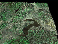
Glacial Lake Missoula filled the valleys of the Clark Fork River in western
Montana, then emptied in a few days as it dumped a great flood across eastern
Washington and down the Columbia River to the Pacific Ocean. We can only
imagine what they might have felt.
|
| ||||||||||||||||||||||||||||||||||||||||||||||
| |||||||||||||||||||||||||||||||||||||||||||||||
|
|